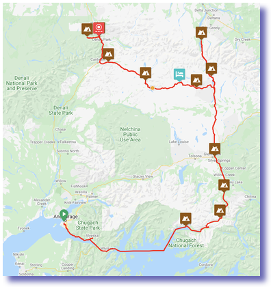
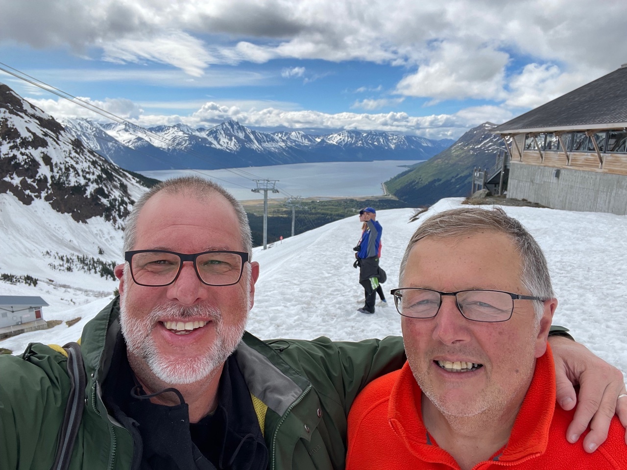
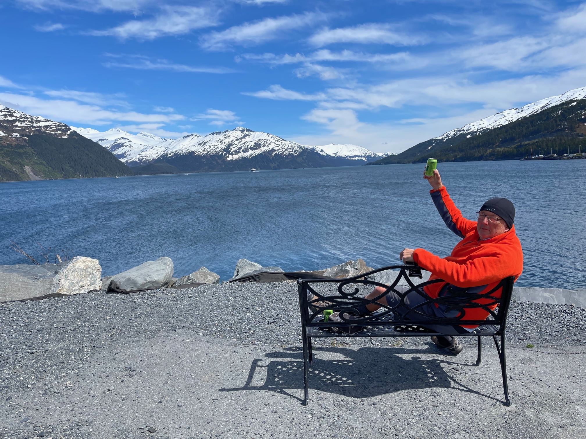
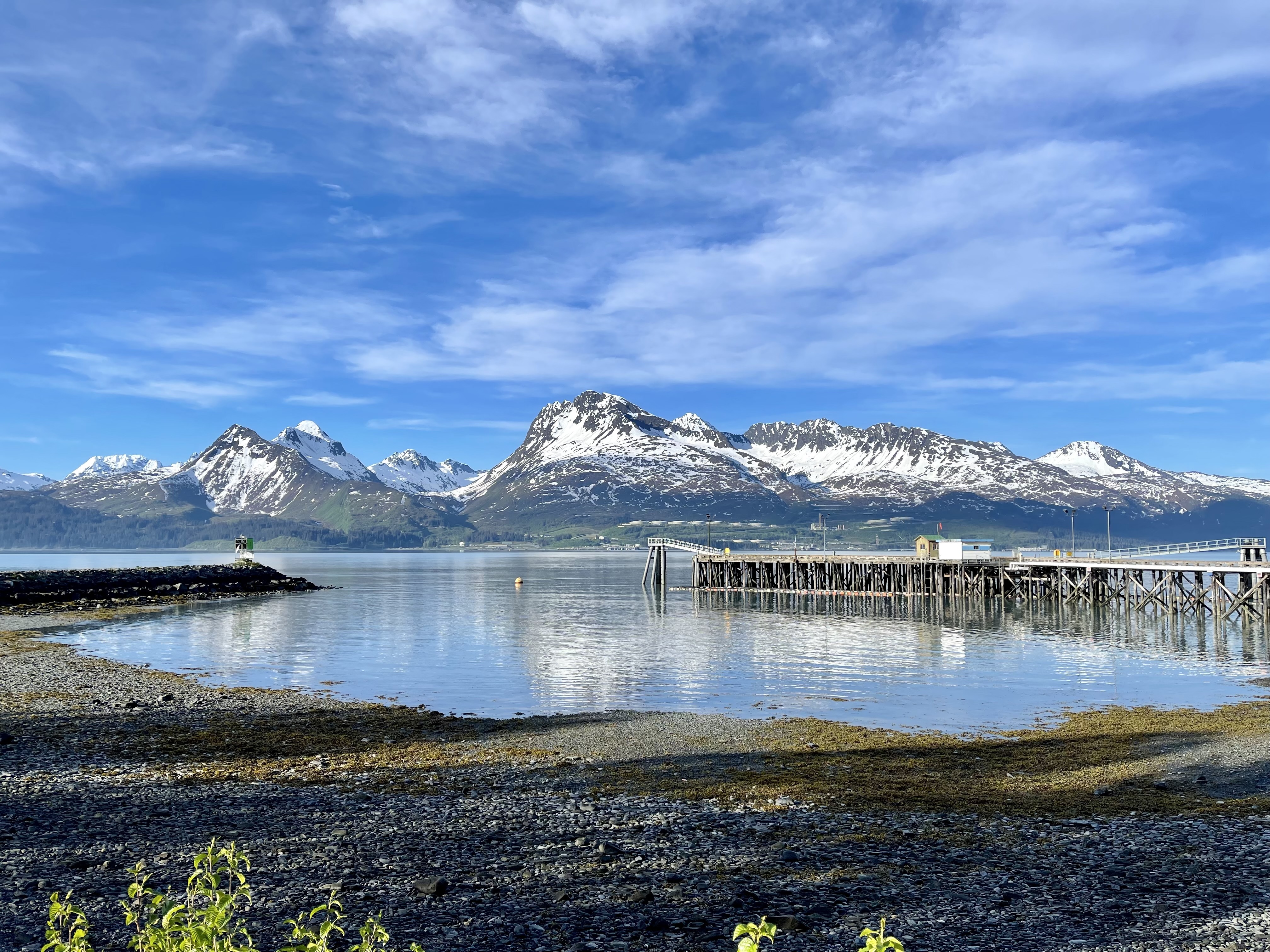
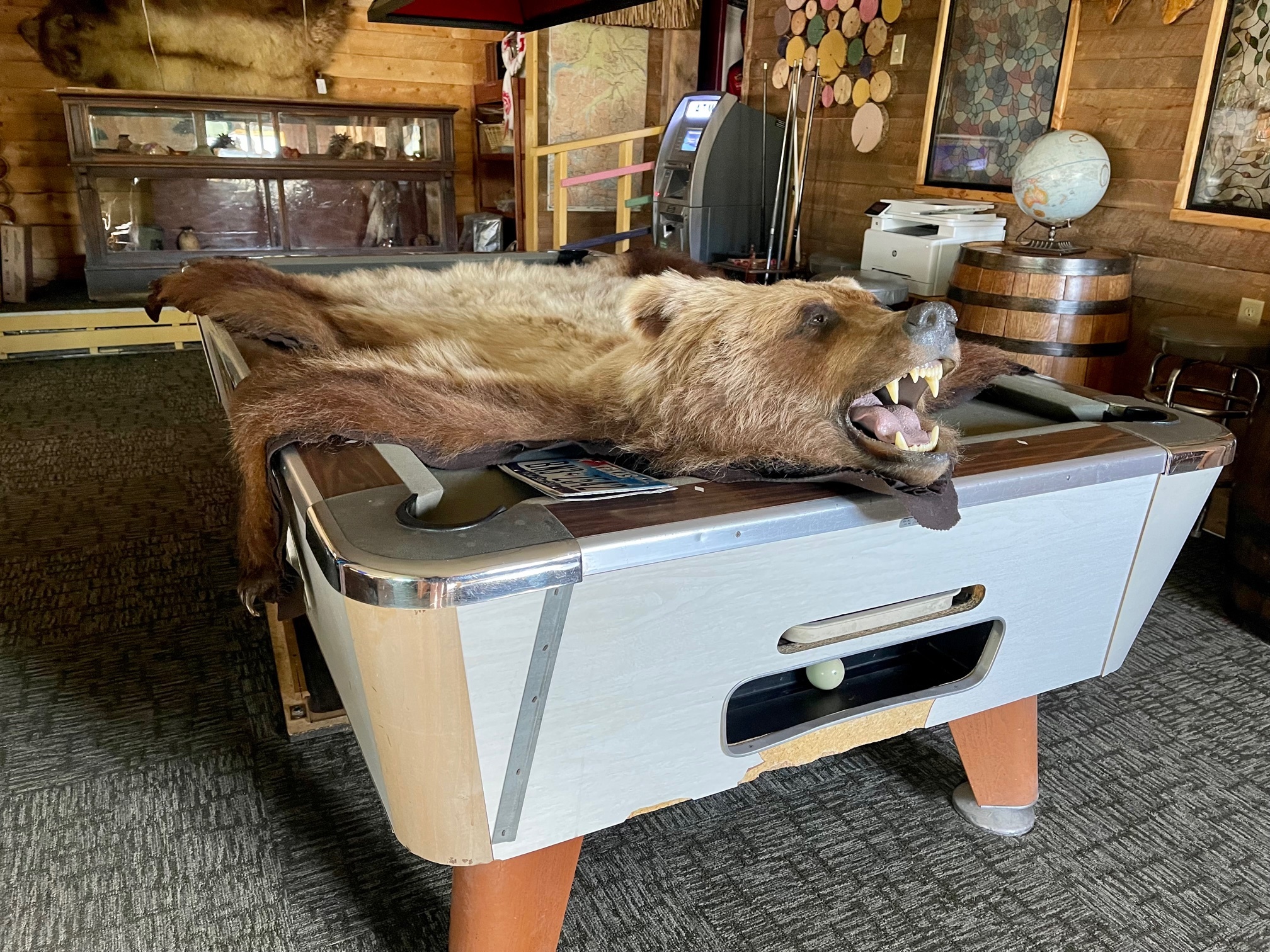
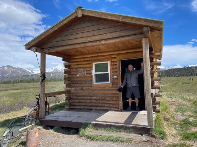
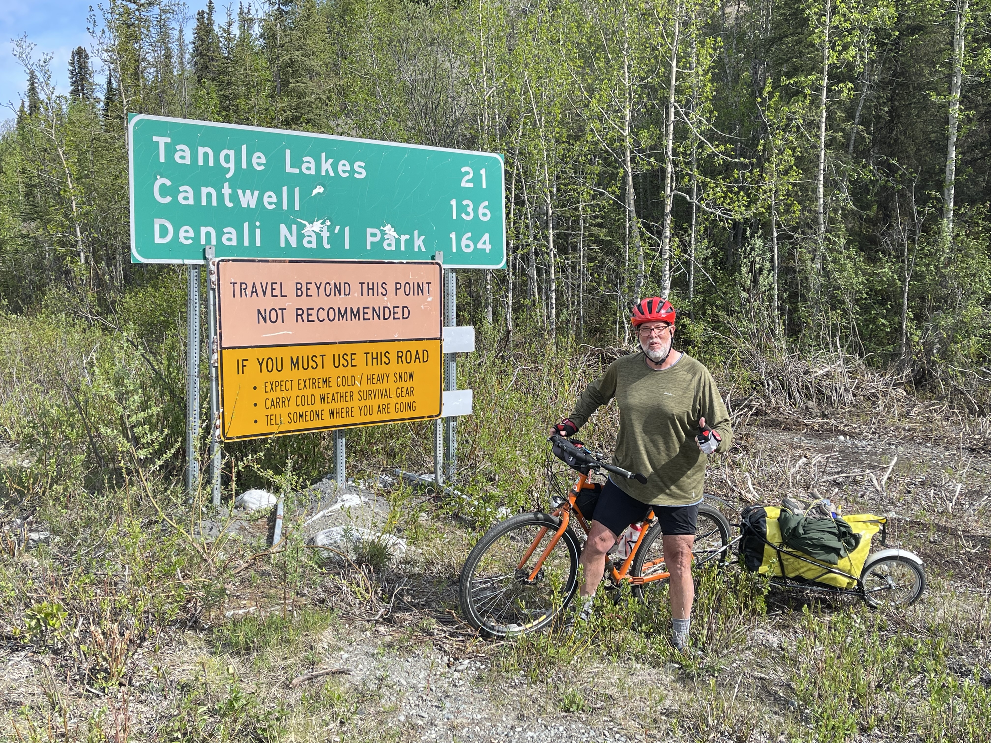
Getting ready
Day 1 - 5/30/2021
7:42 pm
(2020)

My bike’s frame has S&S couplers that break it into two pieces, allowing me to fold up my large touring bike into the bag in the middle.

My Bob single-wheel trailer is in the bag on the right, with all my clothes, bike gear, and camping gear, including tent, stove, etc.

The carry-on has everything that doesn’t fit in the others, plus my headphones for the plane.

The plane gets in at 2am on June 2, so I’ll get to the hotel just after my partner in crime, Henry, gets to sleep. Yes, I’m an awesome friend.

We hit the road on Thursday, June 3.


Trip is happening!
Day 3 - 6/01/2021
4:54 pm
(2026)


Both my bags came in at 50 lbs exactly. Not sure whether to be proud or aghast.


Denali!
Day 4 - 6/02/2021: 14 miles (14 total), 128 feet (128 total)
2:14 pm
(2027)


Very bad connectivity even in Anchorage. Not sure how many pictures will be uploaded until we finish!


12:09 am

Putting the bike together was my biggest task today. My bike breaks apart so that I can carry it in a standard airline-checkable bag. However, that means I have to completely dissemble it, and reassemble it on the far end, hopefully well enough that it doesn’t fall apart when we head out into the wilds. Took a couple hours.

We then followed a keleher before-trip tradition of going to REI, my Happy Place. But something was different! The sign outside said “Masks optional” for the vaccinated …. so in we went. Then we went out for pizza (perhaps the garlic was a mistake for two guys who are sharing a small hotel room). There was also not a mask in sight at that restaurant, or the Korean restaurant we went to for dinner. How quickly the normal changes.

We got a ton of freeze-dried dinners, stove fuel, and bear spray. Not sure if that was a wise purchase, but it makes us feel a bit better.

Once back to the room I tossed all my gear in the bob bag (I’m pulling a trailer rather than using panniers), or at least tried to. Turns out that I no longer know how to pack, and the three bags I brought (50, 50, and 23 lbs) turn out to contain too much gear. Who knew? A couple hours later I had winnowed the pile down to something doable, and we went out for Korean.

We also visited the seaplane base across the road. They claim it’s the biggest in the world, and there do seem to be thousands of planes there. Sadly too spread out to get decent photos in the rain, and there weren’t any taking off or landing near me when I was there. As I was cruising around on my bike I noticed a sign saying “Airplanes have rightaway”, and sure enough I soon heard and saw a plane taxiing up behind me in my rear view mirror. I practically dove off the road.

Tomorrow we start in the actual tour with a 40-mile ride along the coast to the alyeska resort. The day after we take a short train ride from Girdwood to Whittier, where we will pick up our ferry for the six-hour trip to Valdez.

After this, the tour begins in earnest with a 2800-foot climb from sea-level over the Thompson pass into the wilds.


Anchorage to Girdwood
Day 5 - 6/03/2021: 41 miles (55 total), 1152 feet (1280 total)
9:20 pm
(2030)

Today was in some sense a shakedown cruise: 41-ish miles, only about 1000 ft climbing, and not in the mountains proper, but look at the freakin’ pictures!

The body of water is the Turnagain Arm, a place that has the second highest tide in the world: 30 feet. You can see that it’s currently low tide, leaving a whole topography of crags and cracks. Must be pretty interesting when the tide comes in.

We spent the first 25 miles on the highway out of Anchorage which wasn’t too bad, traffic-wise, and pretty great on the scenery. The last 15-plus miles were on the Bird-to-Gird pathway: a paved path that winds back and forth across (and under) the highway, ending up at the Alyeska Resort, a place that reminds me of Chamonix, though skiing and snowboarding stopped two weeks ago, mountain-biking not to start for another two weeks hence. No parasailers, sadly.

Tomorrow we take the train to Whittier, and then jump on a six-hour ferry forValdez, where we head uphill.


Trains and Ferries and Bikes, Oh my!
Day 6 - 6/04/2021: 14 miles (69 total)
2:02 am
(2031)

Thursday night we roughed it at the Alyeska resort: great burger and a couple beers, taking the tram up the mountain to drink another beer with a dramatic vista from well above the tree-line, taking a completely undeserved series of alternating dips in the hot tub and pool, and finishing with surprisingly good Quattro Formaggio pizza room service while watching the Phoenix Suns eliminate LeBron James from the NBA playoffs. Henry was asleep well before the game hit half time.

Today was a train and the ferry, both of which we pretty neat. The “Glacier Express” took us past probably a dozen glaciers that we could see, plus others that we couldn’t. The ferry went up a beautiful channel, calm water, bluebird day.

We are now set up at the “Adult BearPaw Park”. No bears, but I did have two large bunnies just hop through.

Tomorrow is The Hill! Probably the toughest day on this tour unless weather turns bad. Also, first day camping.

T-Mobile has sucked here, though Henry’s Verizon seems pretty good. Tomorrow we’ll probably have neither, but if we get into any trouble we have the sat phone.


Leaving Valdez
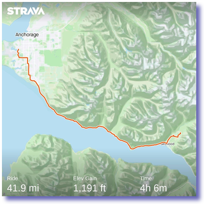
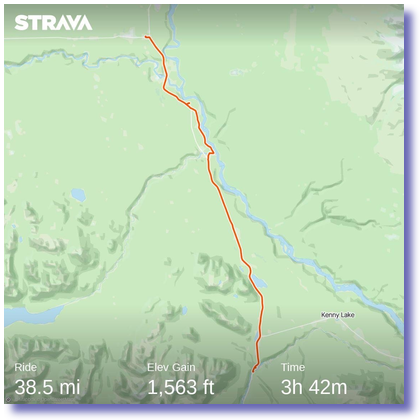
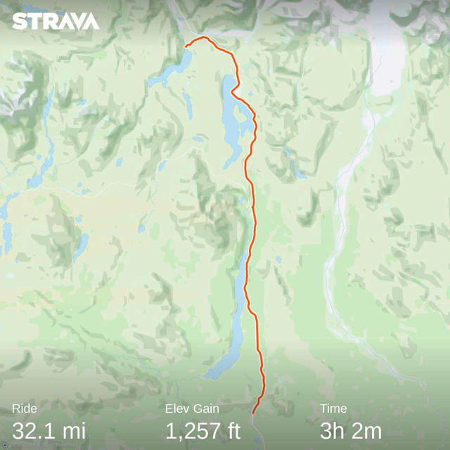
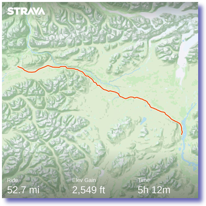
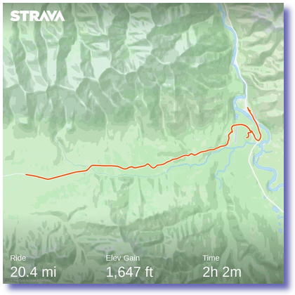
Day 7 - 6/05/2021: 56.2 miles (125 total), 3155 feet (4435 total)
12:22 pm
(2032)

Flashback: 
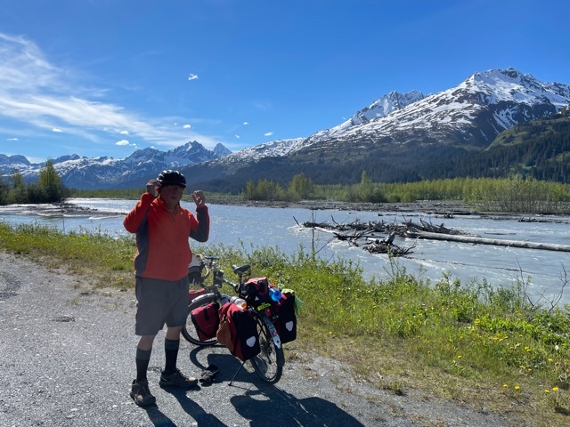
Yesterday morning we hit what I think of as The Hiccup. During the 5-mile bike ride down to the train, I discovered that the rails connecting my seat to the hike had been snapped. Disaster!

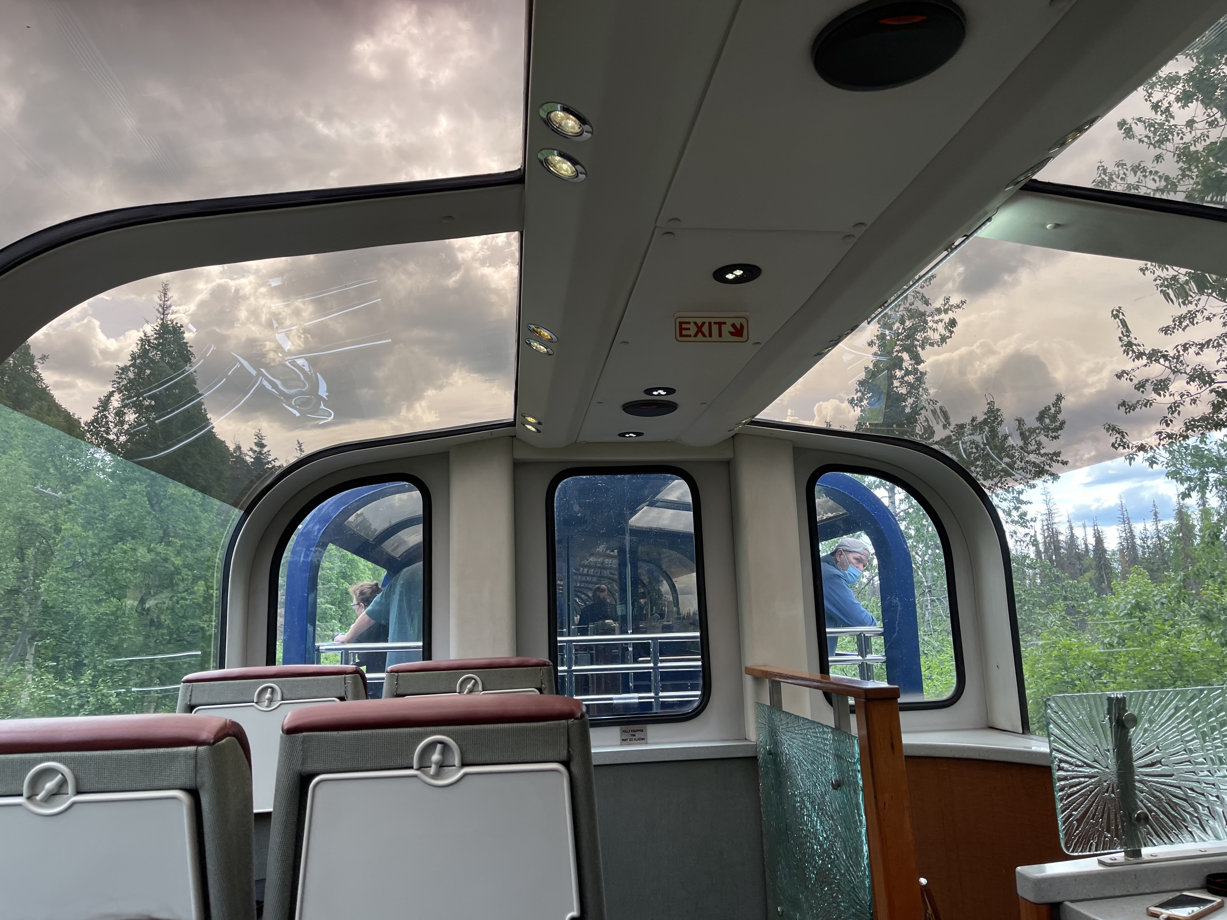
During the train ride to Whittier we reassured each other that we’d be able to find a bike shop in Valdez tomorrow. Once we got to Whittier, though, we were able to fit the rails together in the middle of the clip that holds it to the bike. I then spent 10 minutes riding around, hopping curbs, and generally trying to stress test it. It passed.

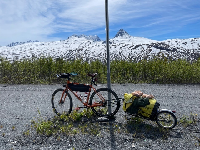
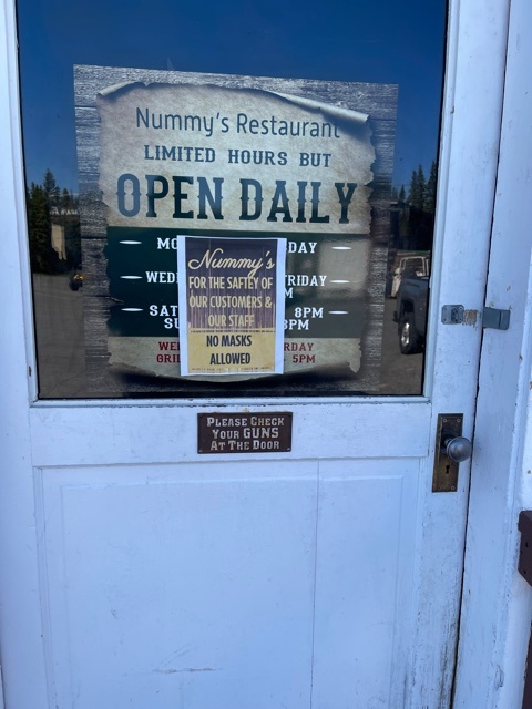
However, I’m not insane enough to go up Thompson pass on a saddle could fail at at minute w/ no backup. Eventually, a kind local volunteered to sell me the saddle off a bike languishing in the hotel’s basement. It’s a pretty good saddle, w/ thick rails. It’s not a Brooks, so I’m going to start tomorrow using my broken saddle, but I’m carrying the other one with me. There does not seem to be any way that the saddle breaking again can cause any issues w/ other parts (better not be famous last words), so we’ll see.

So starting out yesterday morning I felt reasonably confident that I wouldn’t end up coasting down from halfway up Thompson Pass back to the ferry. But still.

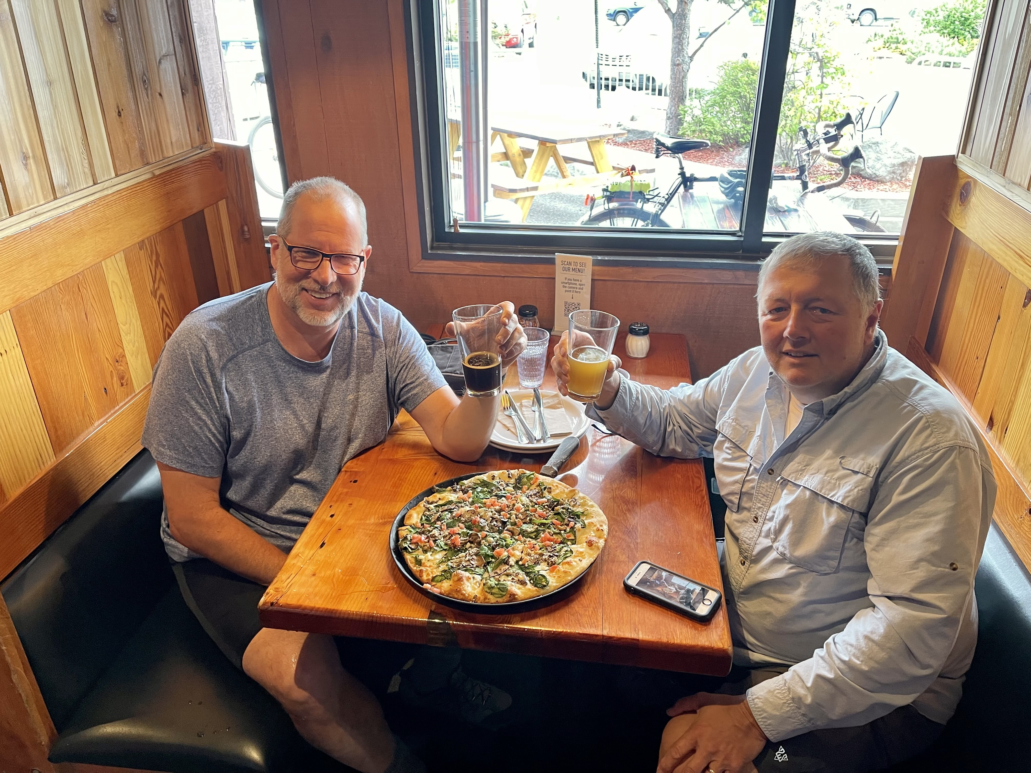
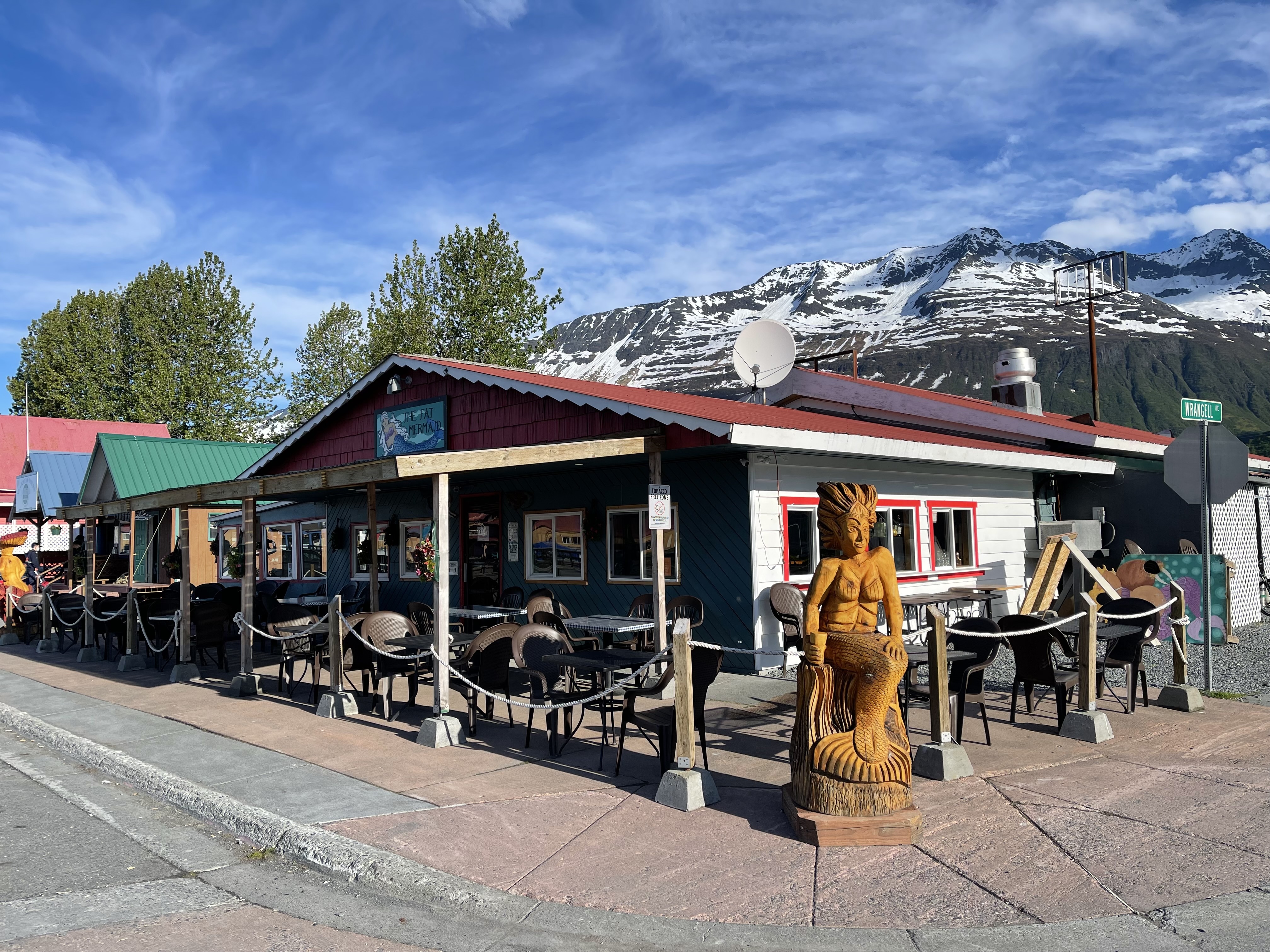
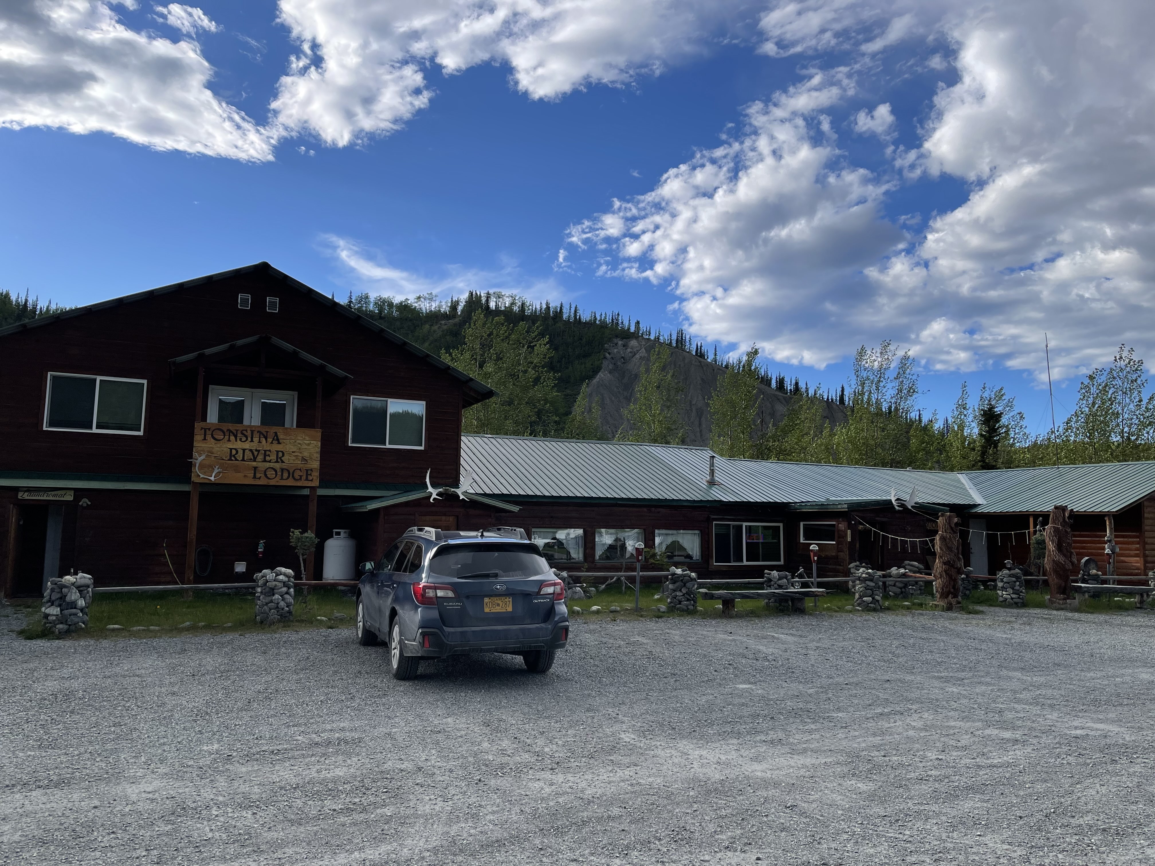
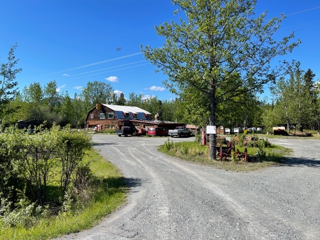
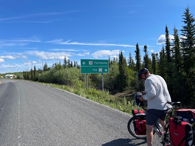
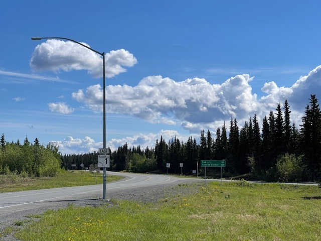
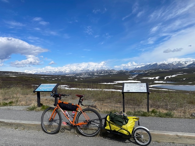
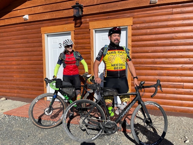
So we set out in the morning the BearPaw Adult RV park (pictures yesterday), stopped in to The Potato for an absolutely fabulous breakfast burrito, then Safeway for supplies, and headed out to the Richardson Highway.

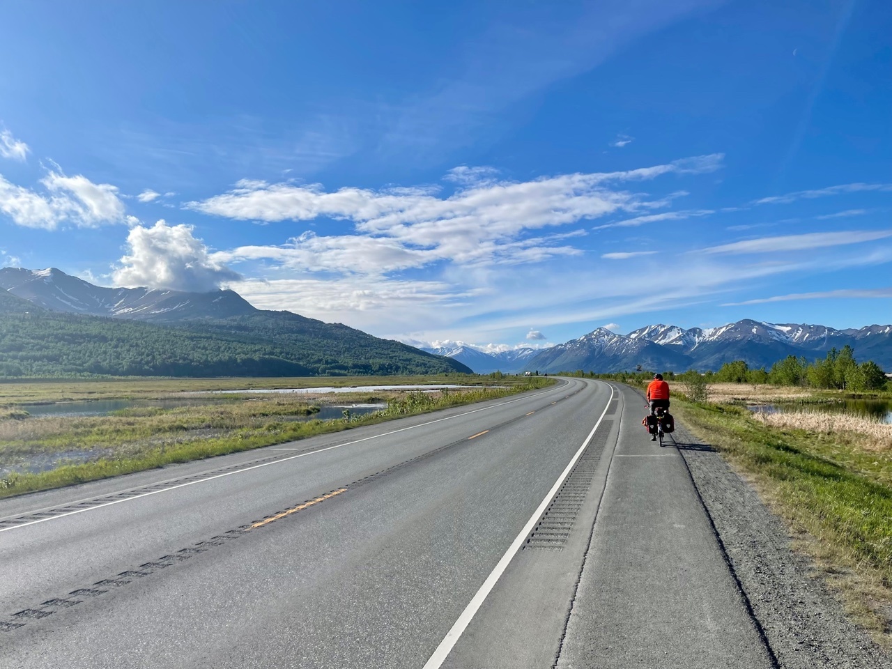
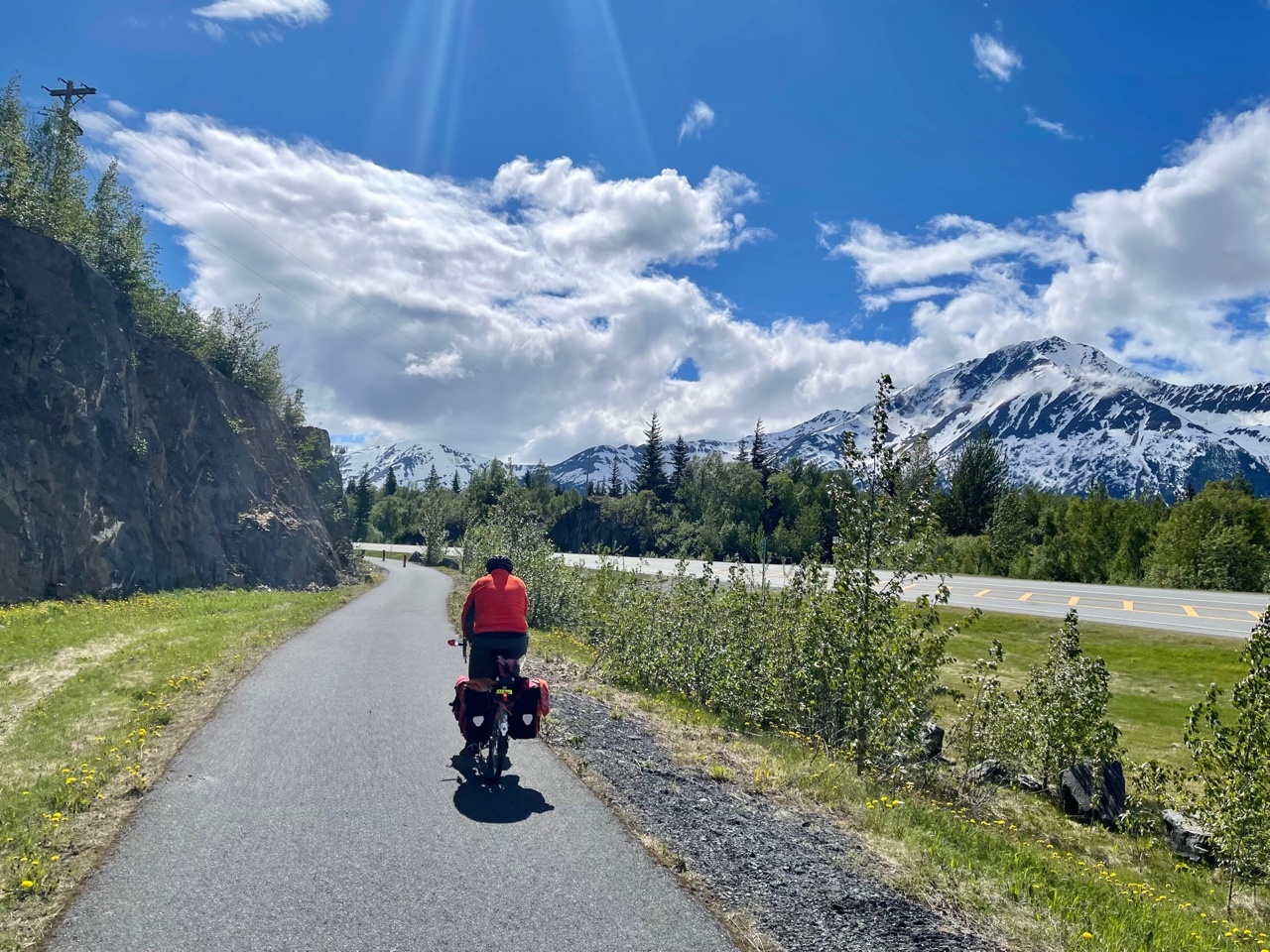
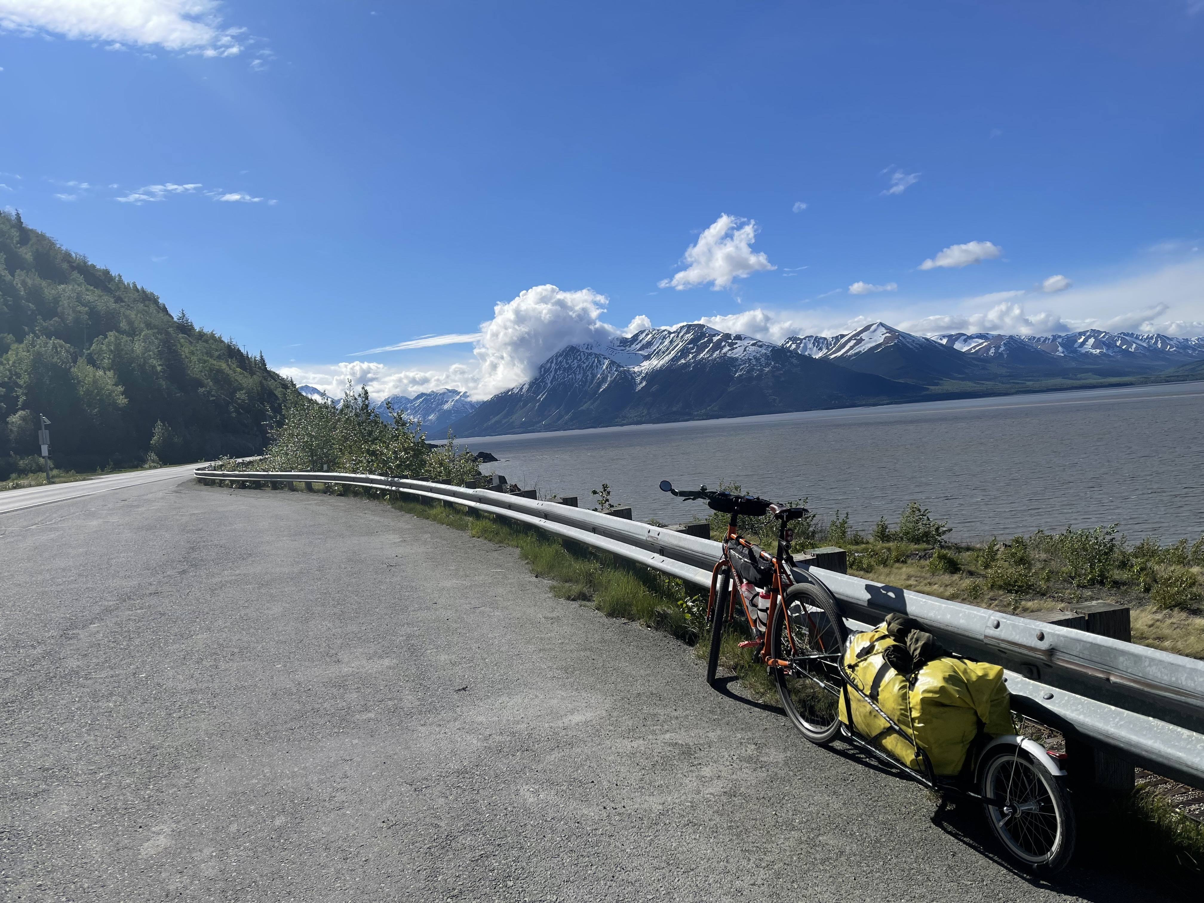
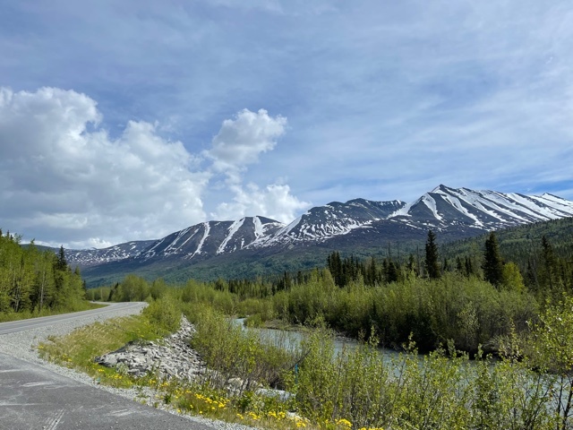
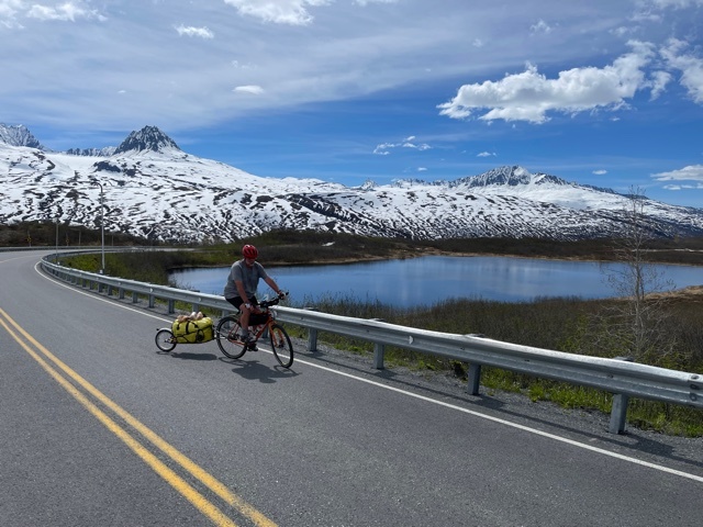
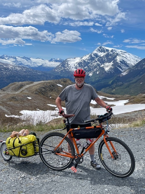
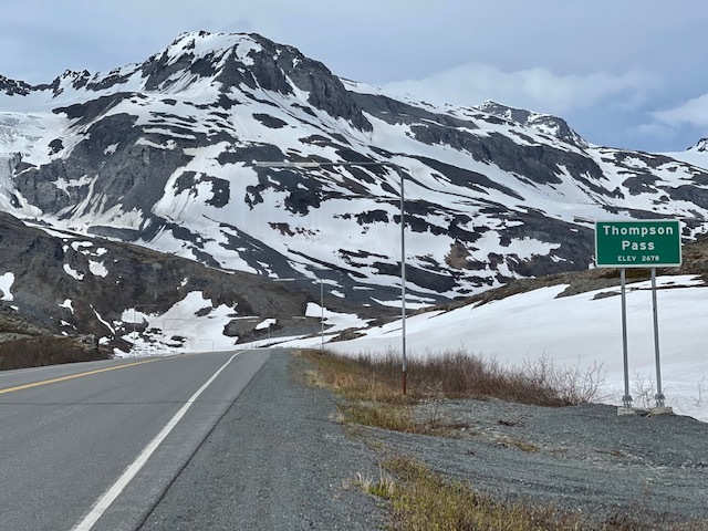
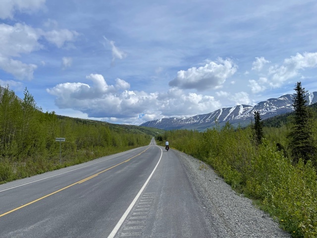
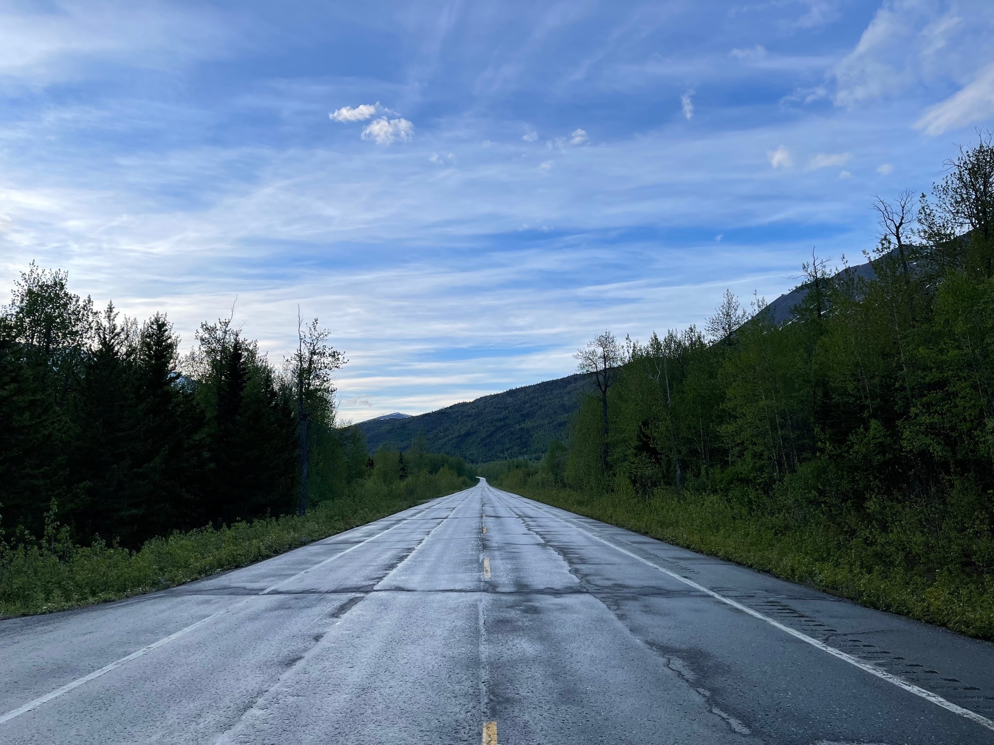
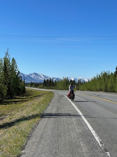
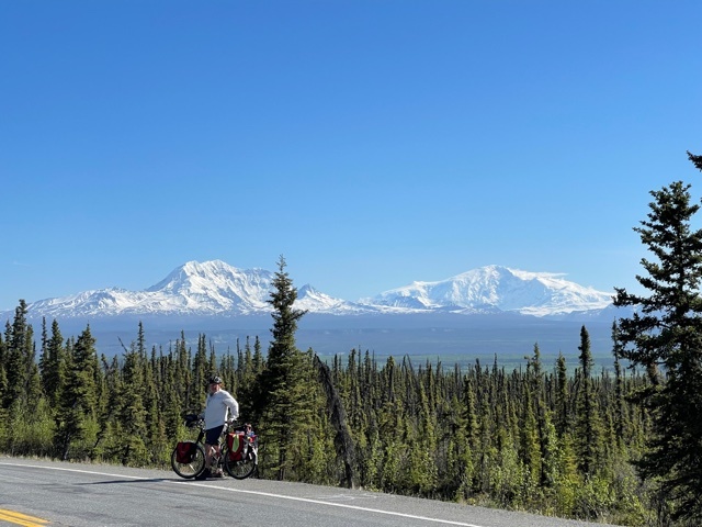
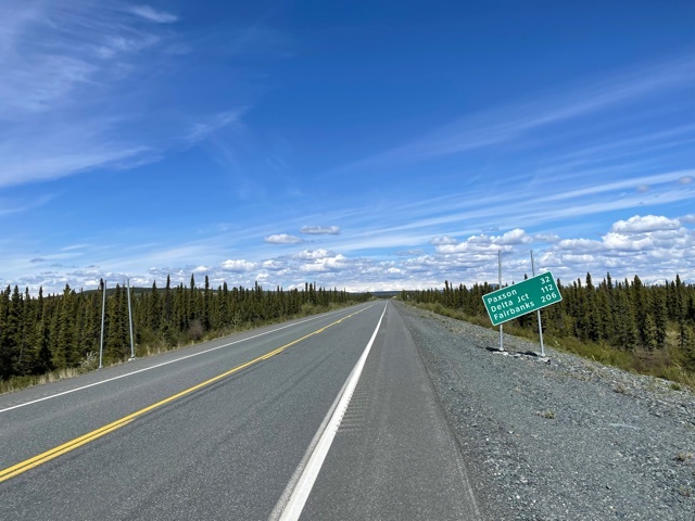
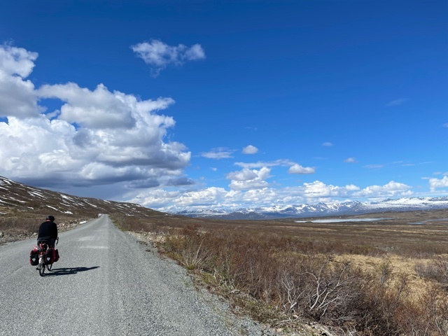
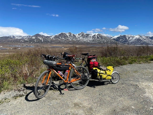
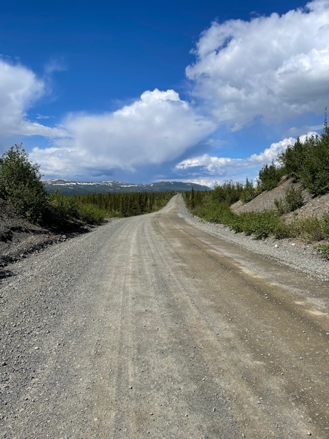
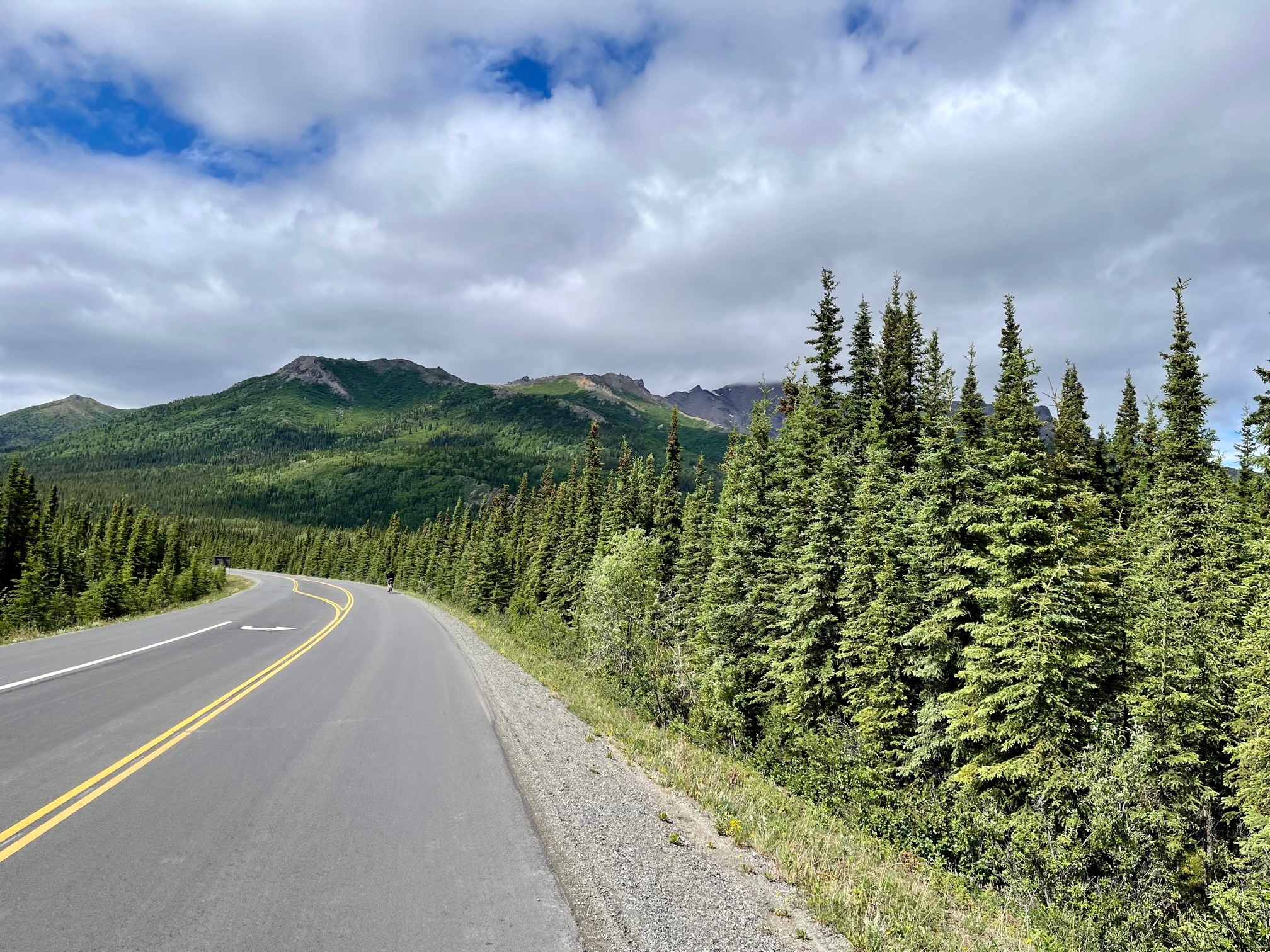
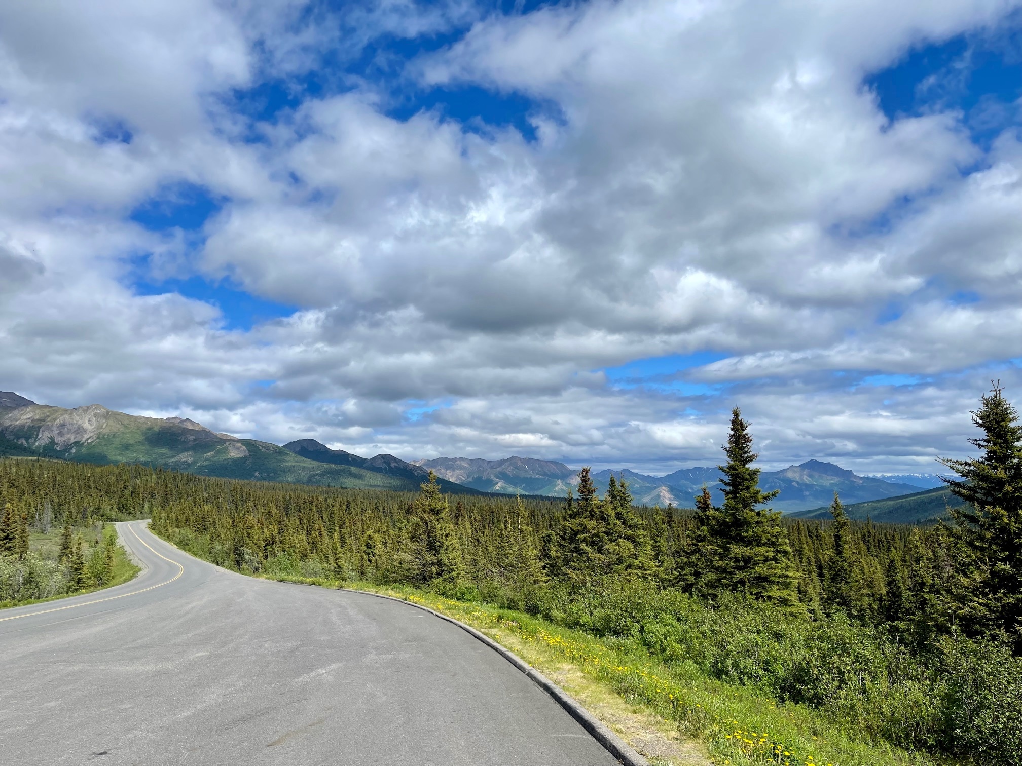
The plan was to go 28 miles up over Richardson Pass, and then another 20 miles to a Wayside at mile 48. We knew that the climb up to the pass (about 2700 feet, starting from sea level), was mostly towards the end, and that turned out to be the case, with only 400 ft gained in the first 20 miles, with a slight tailwind!

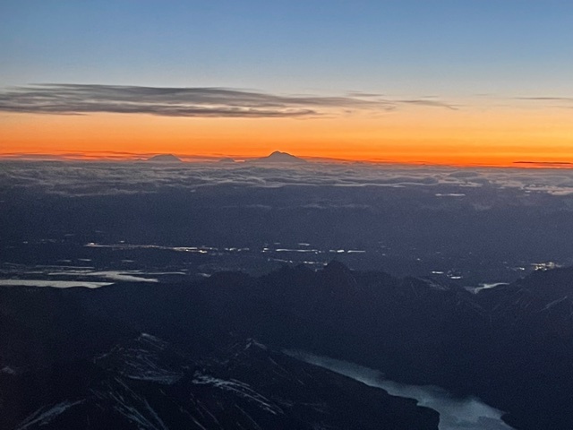
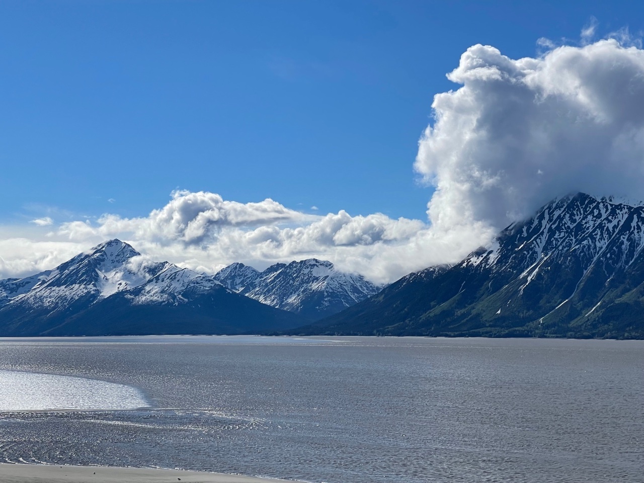
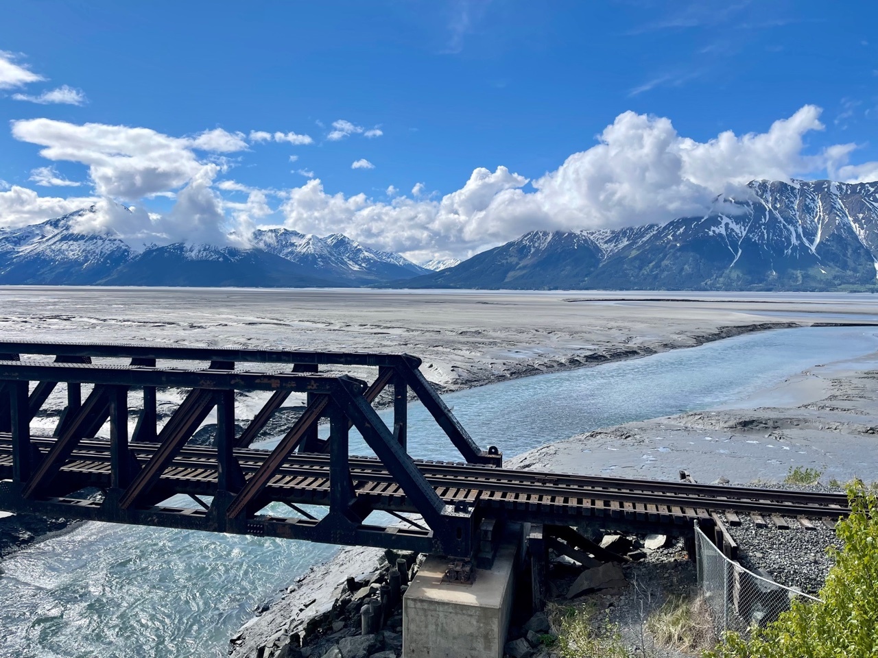
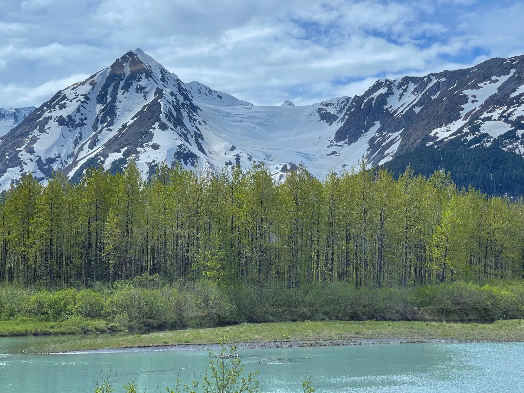
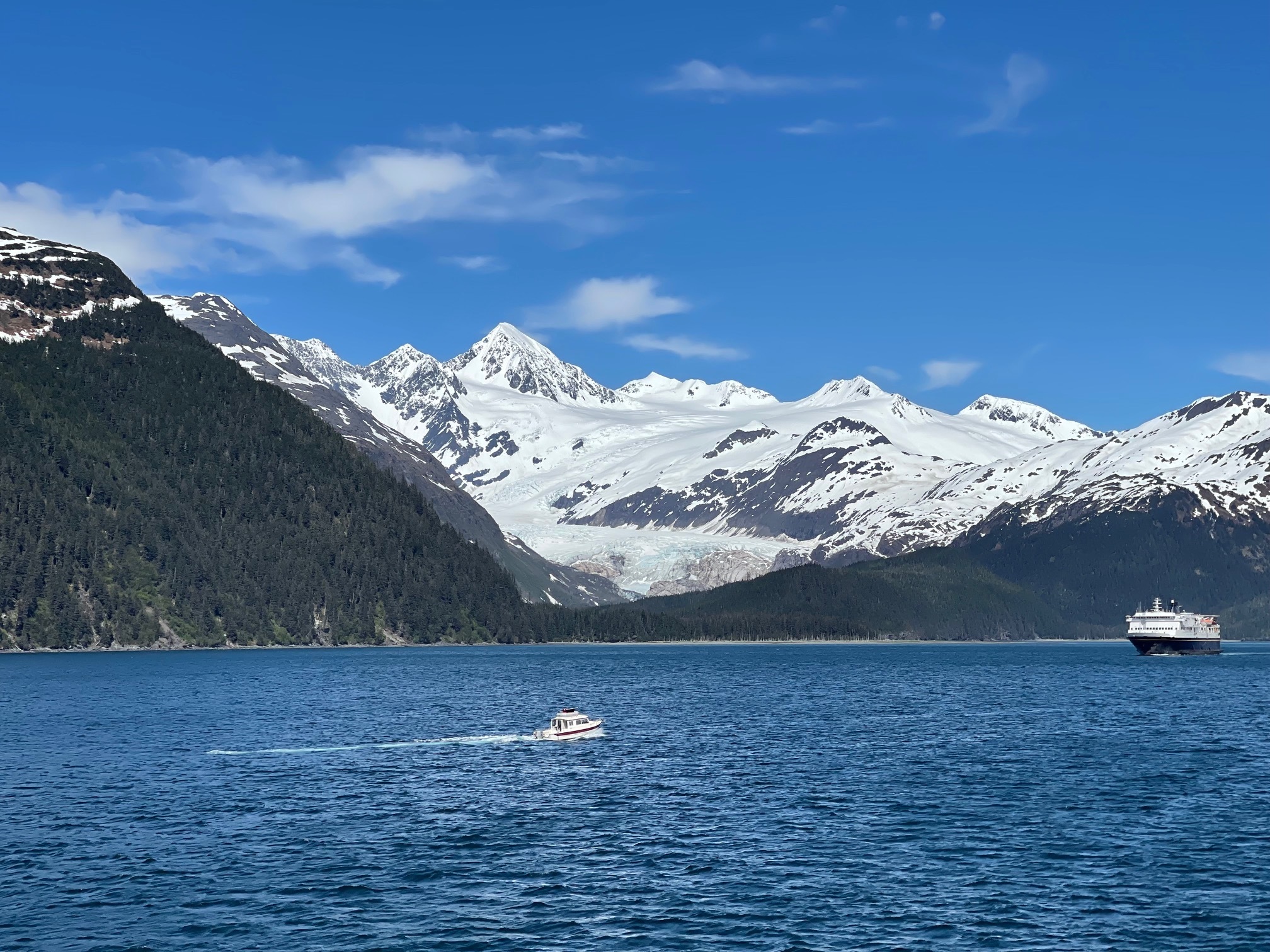
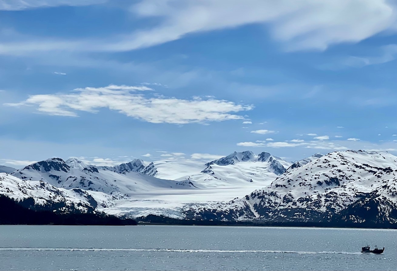
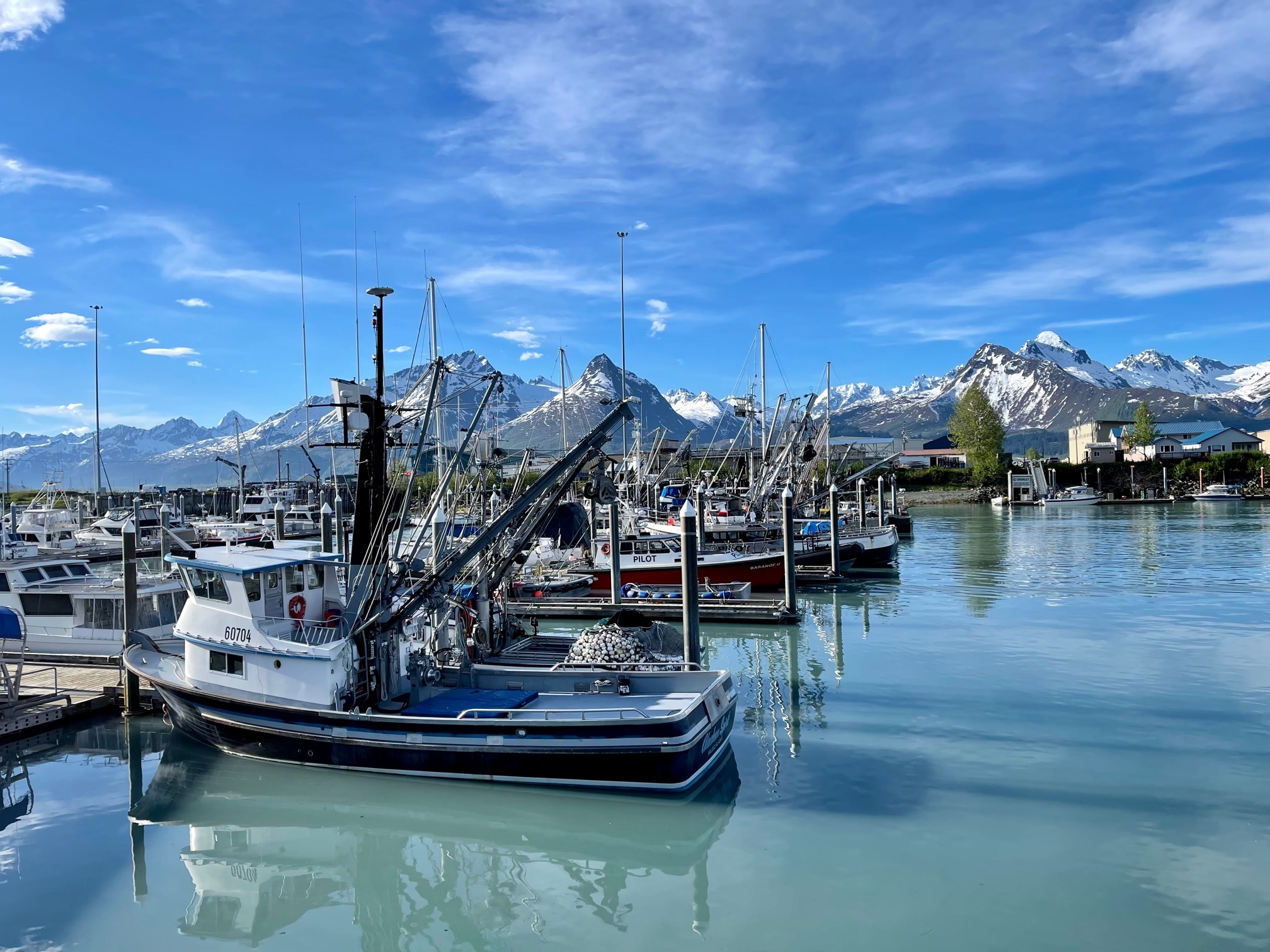
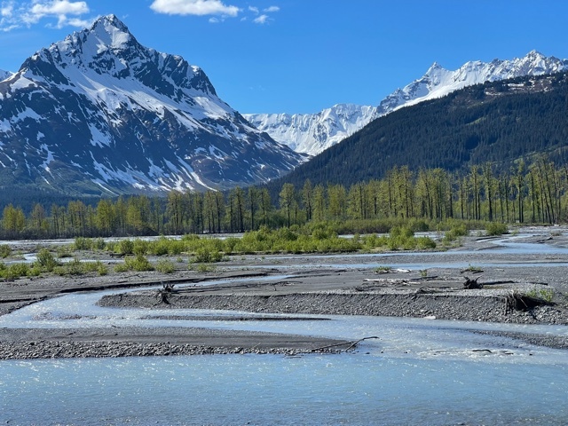
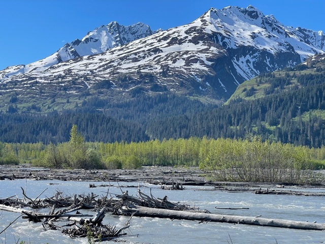
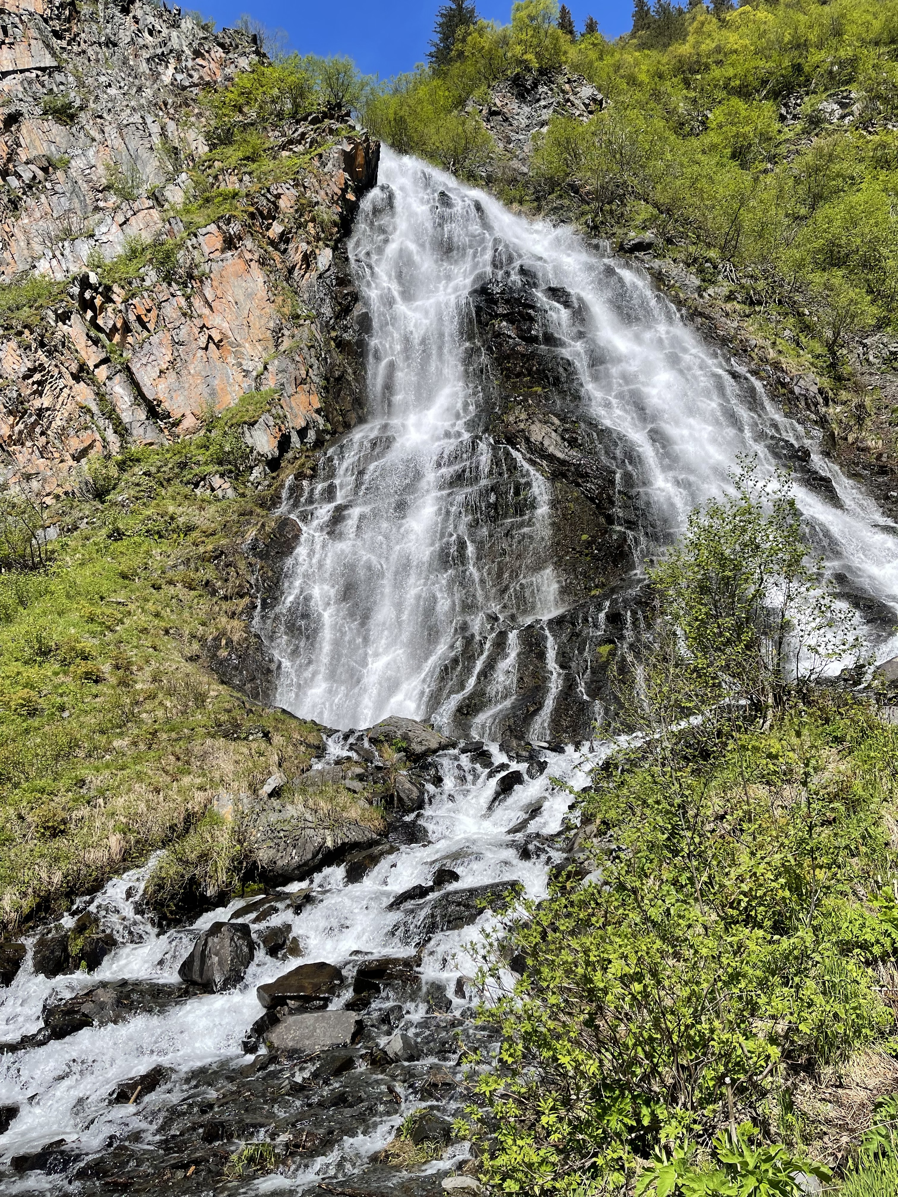
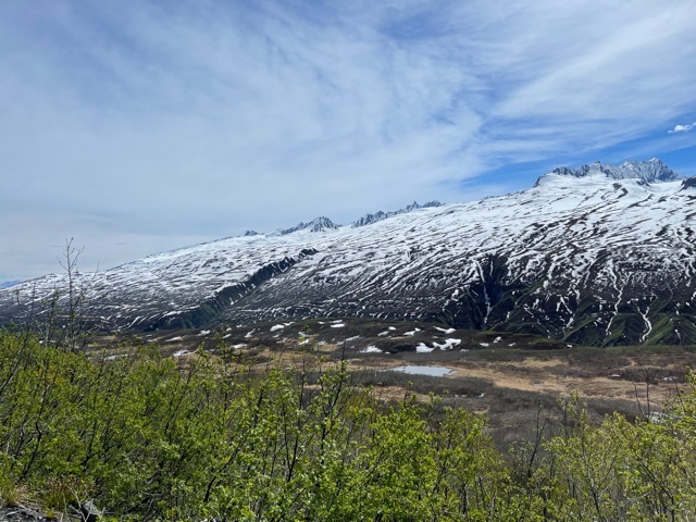
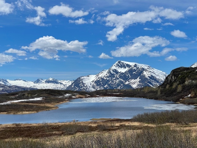
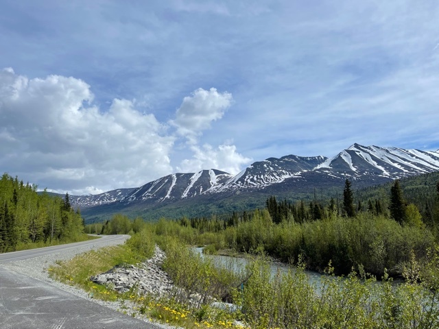
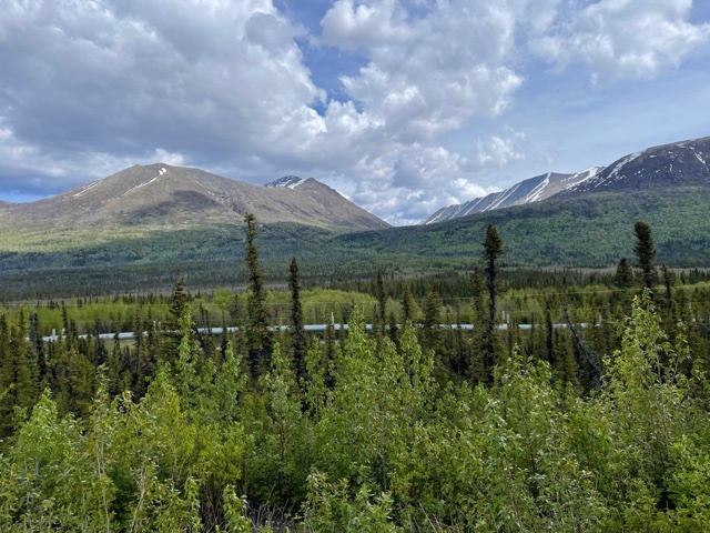
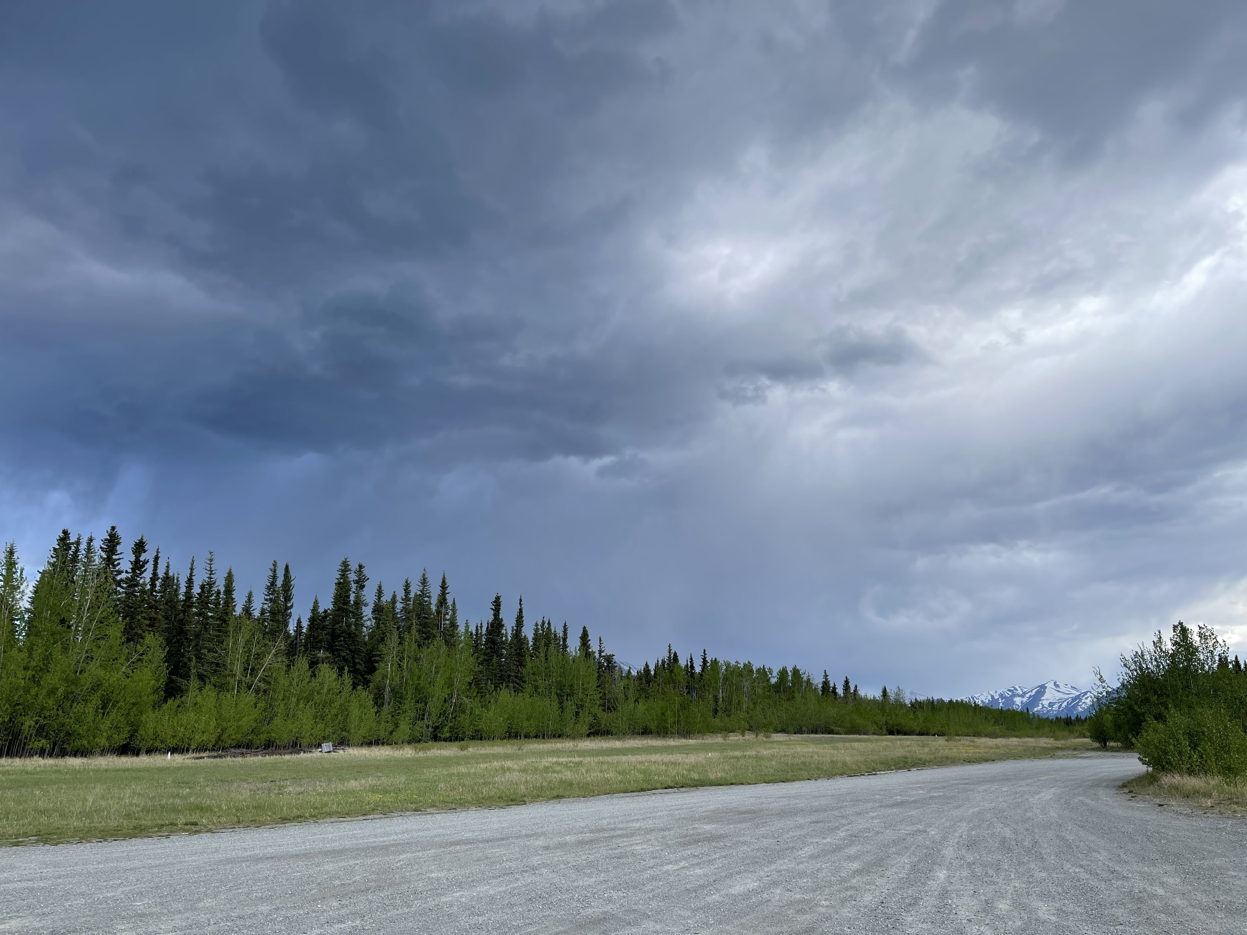
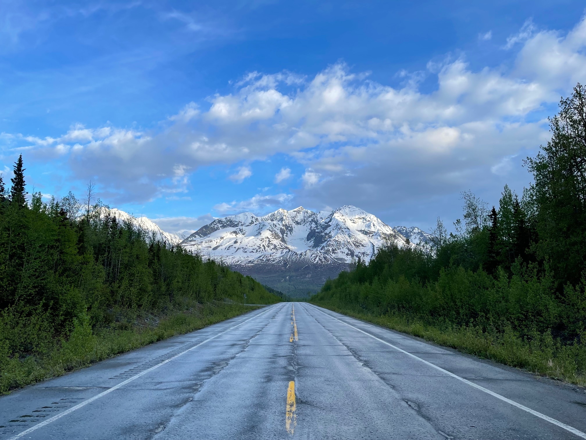
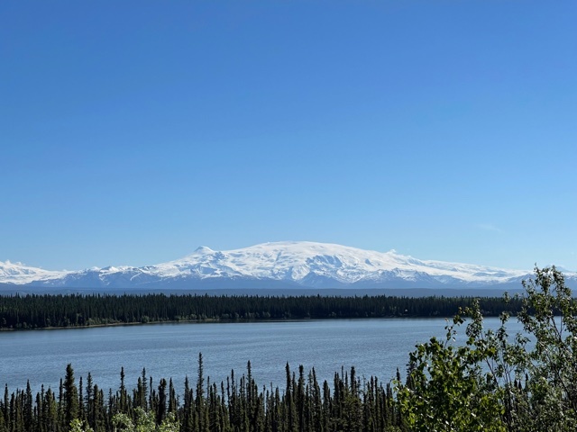
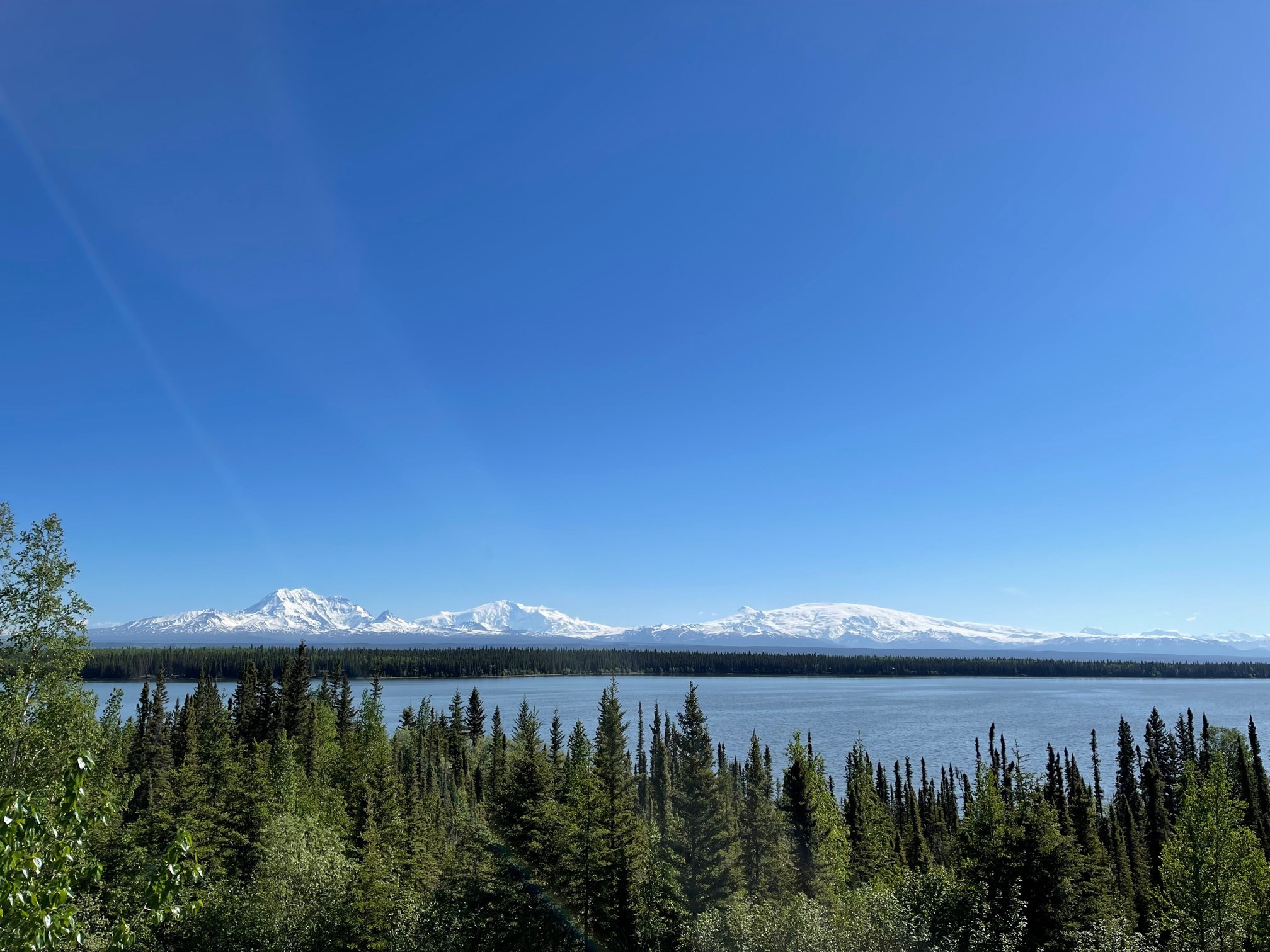
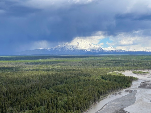
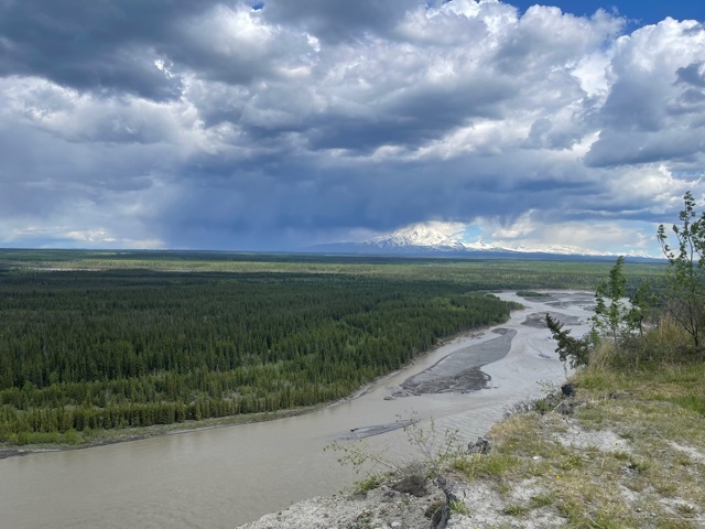
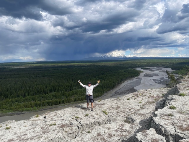
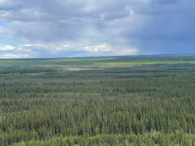
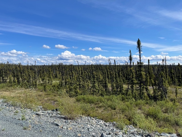
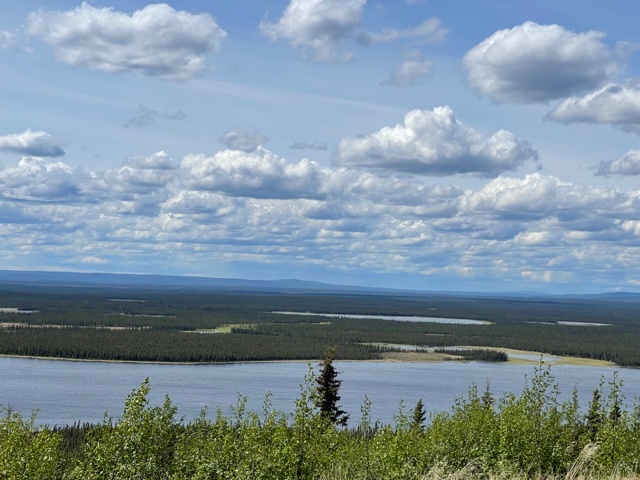
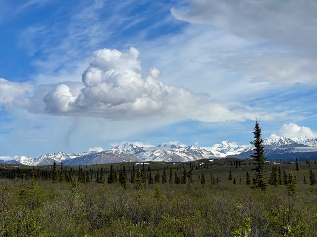
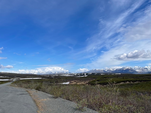
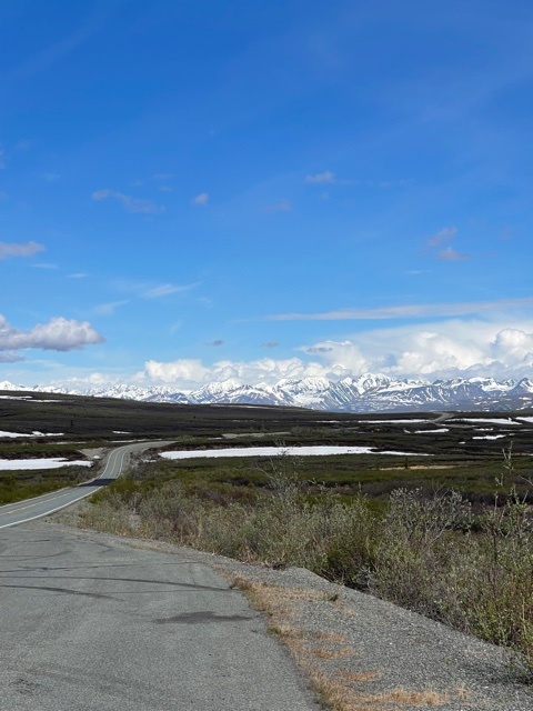
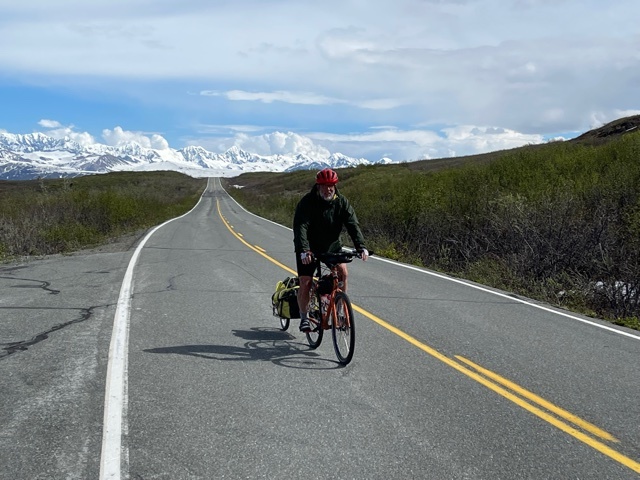
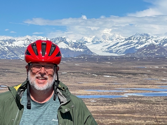
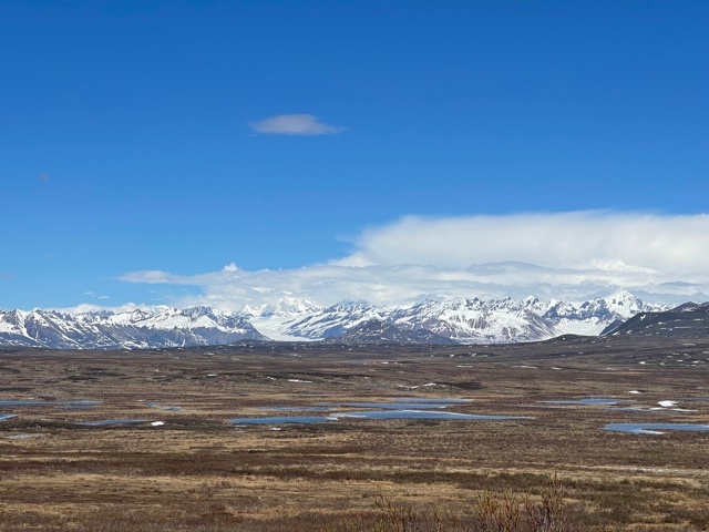
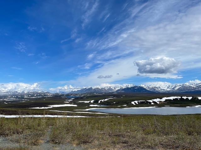
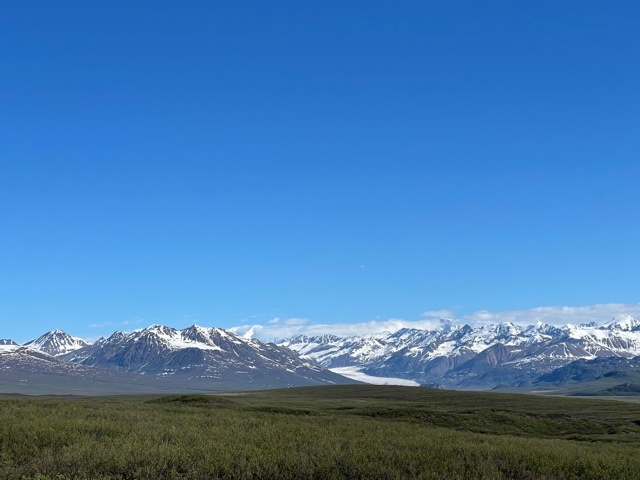
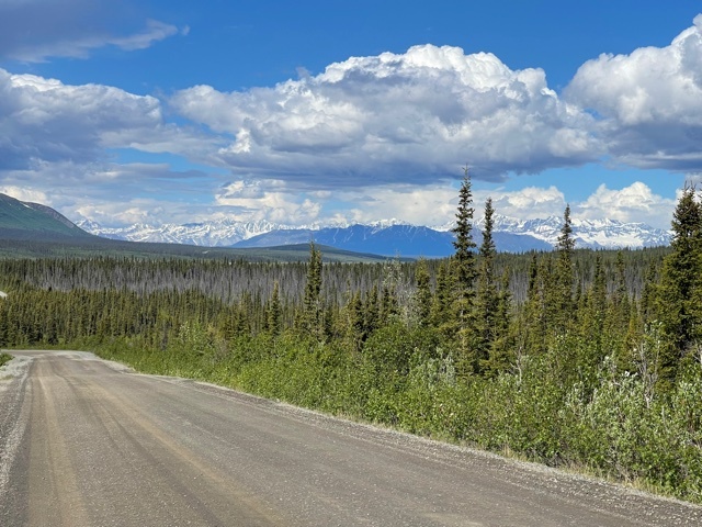
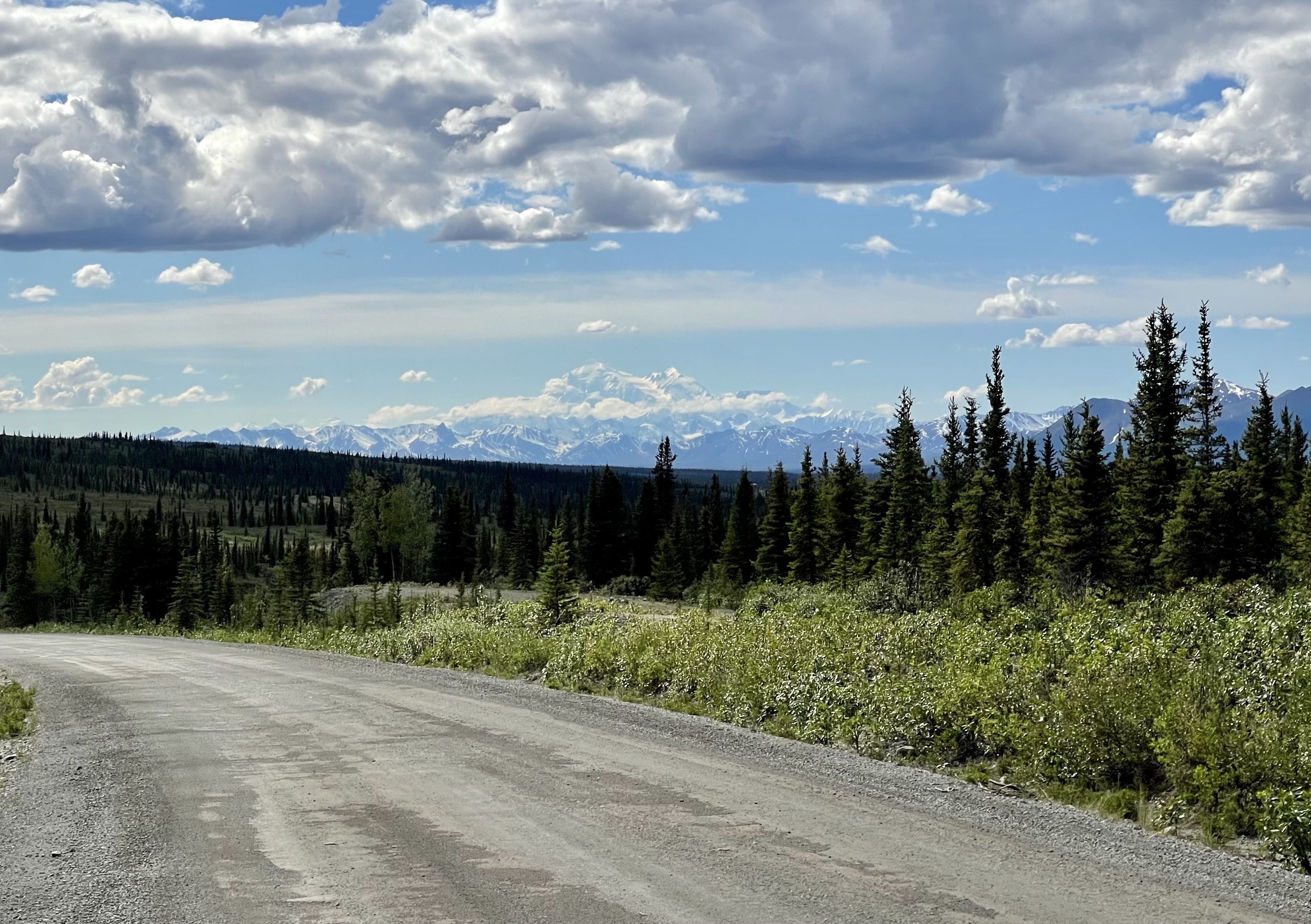
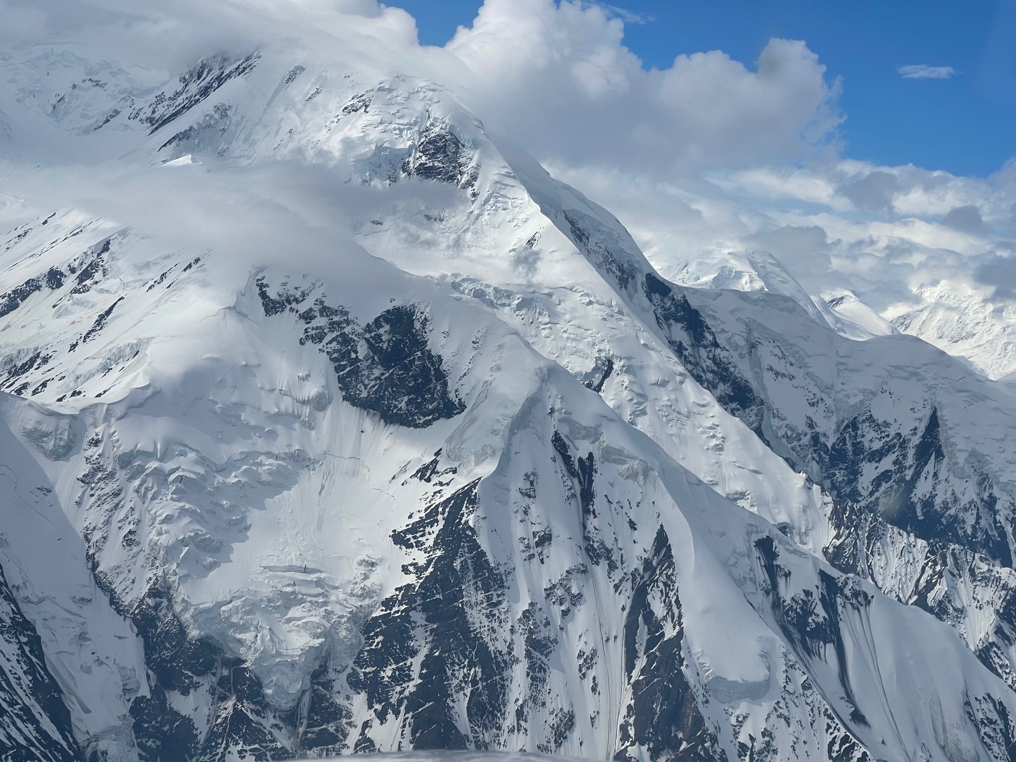
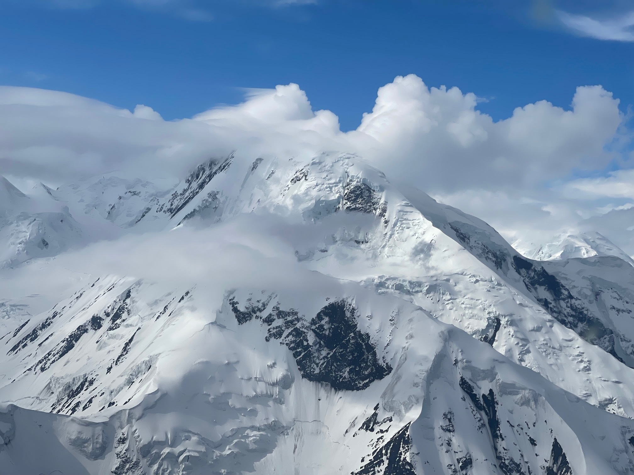
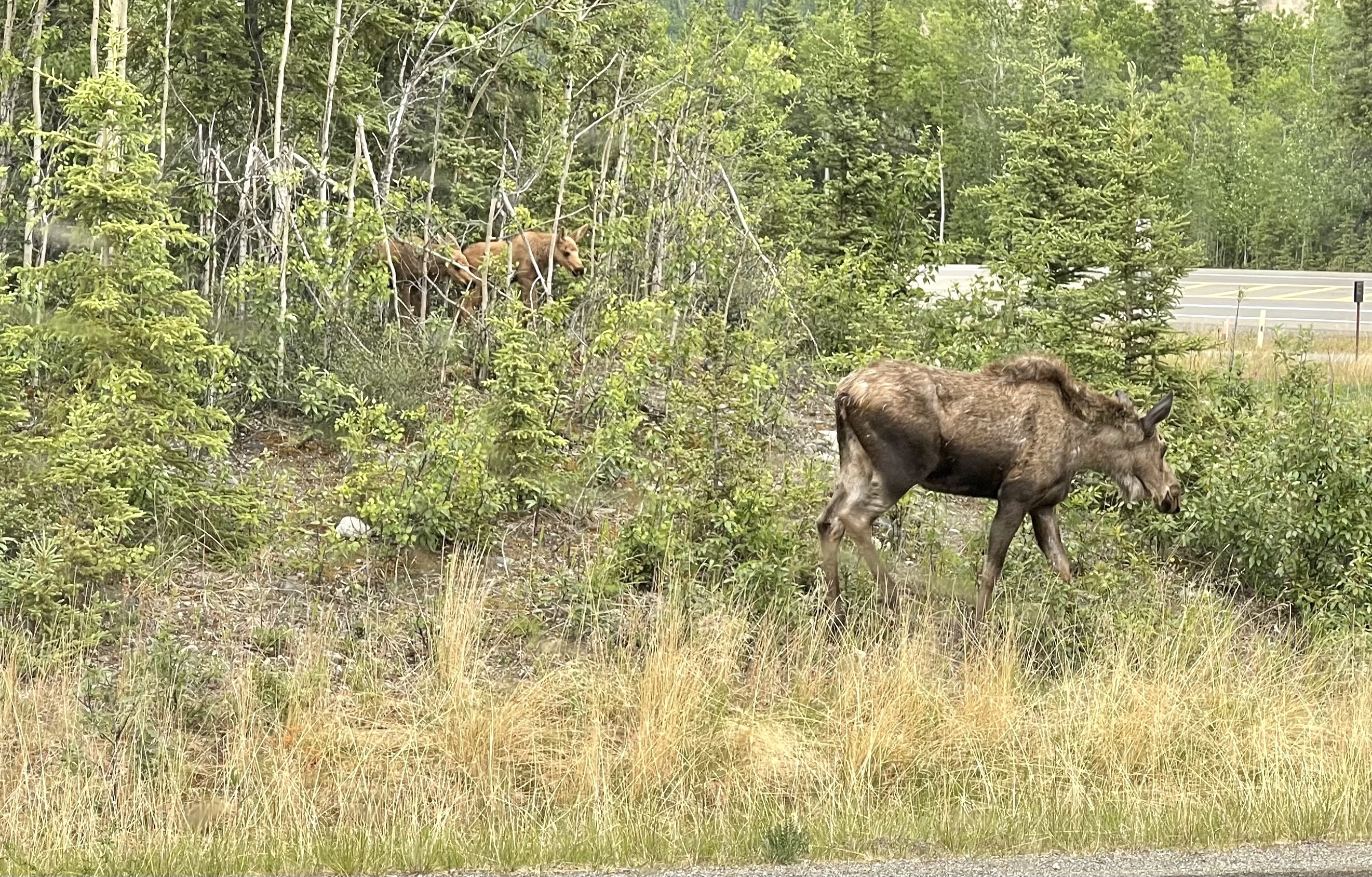
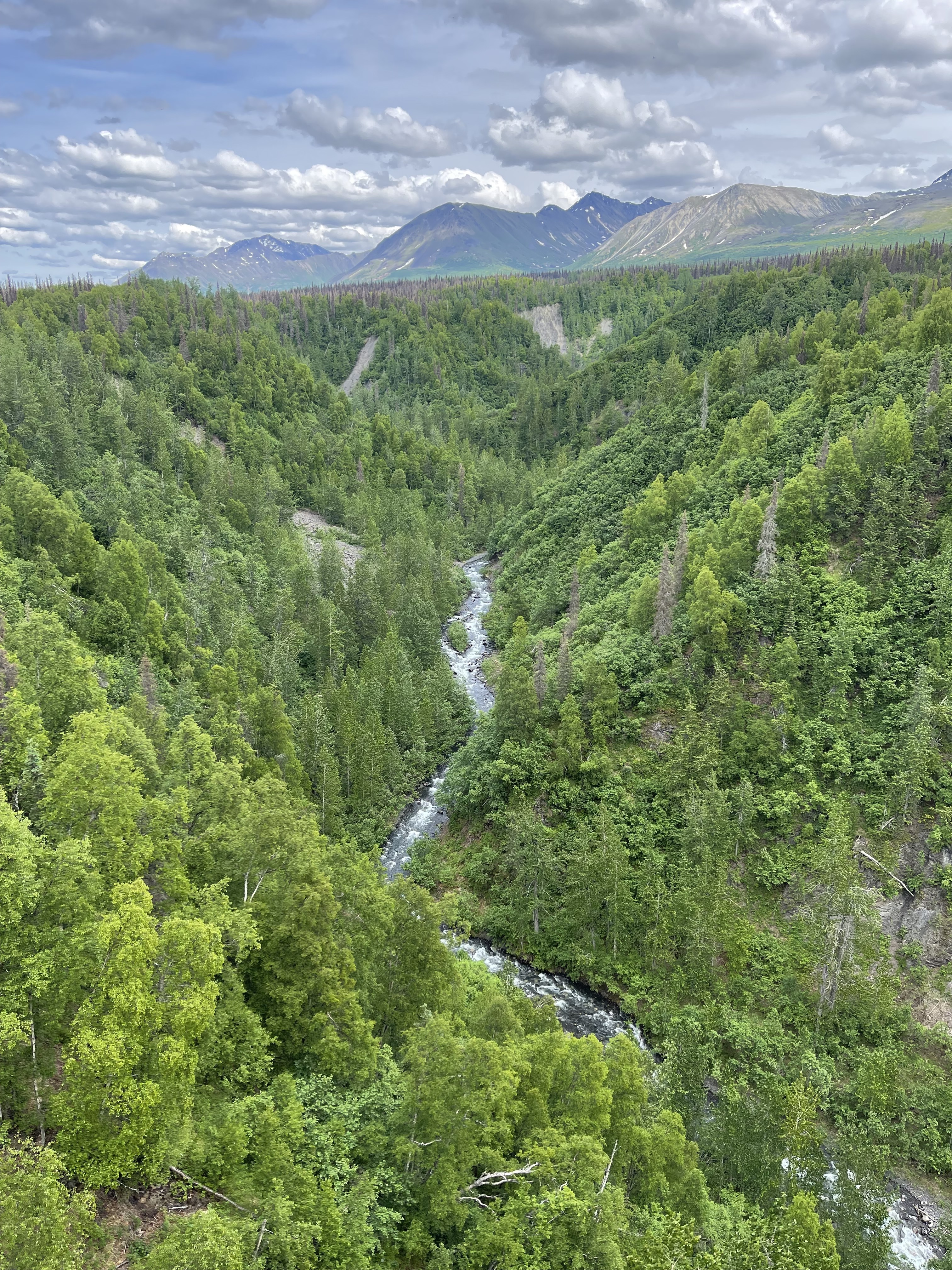
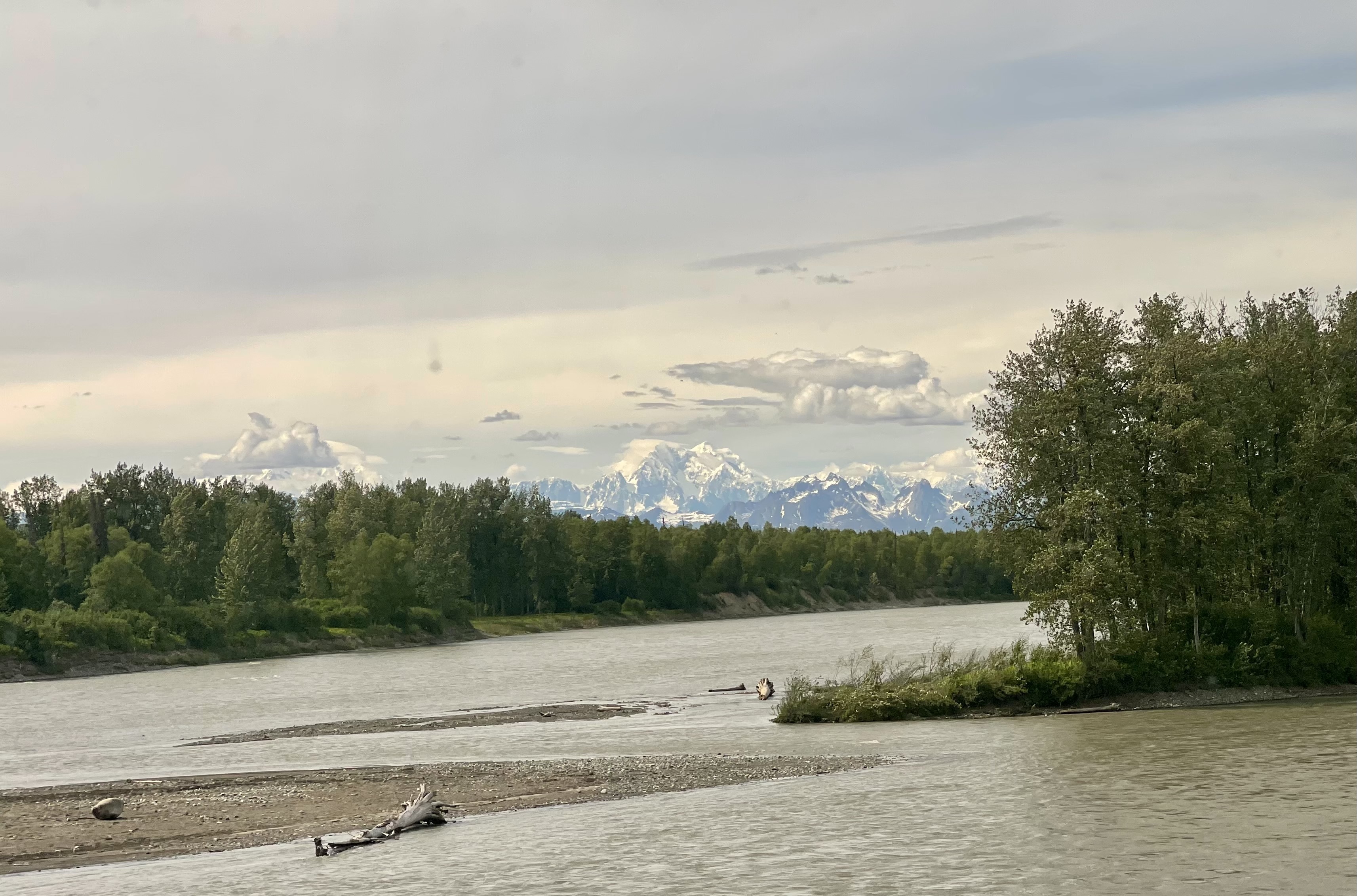
The last 7-8 miles were a different story. Pretty much 4.5% the rest of the way. The route meandered through and around a series of canyons w/ what looked like the alps in front of us. Granted, much lower and smaller, but covered in snow and with glaciers everywhere. We talk about glaciers disappearing a lot, and they are, but on this part of the Richardson Highway we passed many dozen. Many have patches of blue ice showing through as the surface snow melts away.

One of the first we passed (while still on the train) the narrator told us was relatively shallow. The entire glacier was old, but as the glacier oozed down the mountain it lost ice on the bottom as more gets packed on top, resulting in this glacier’s snow averaging only 150 years old.

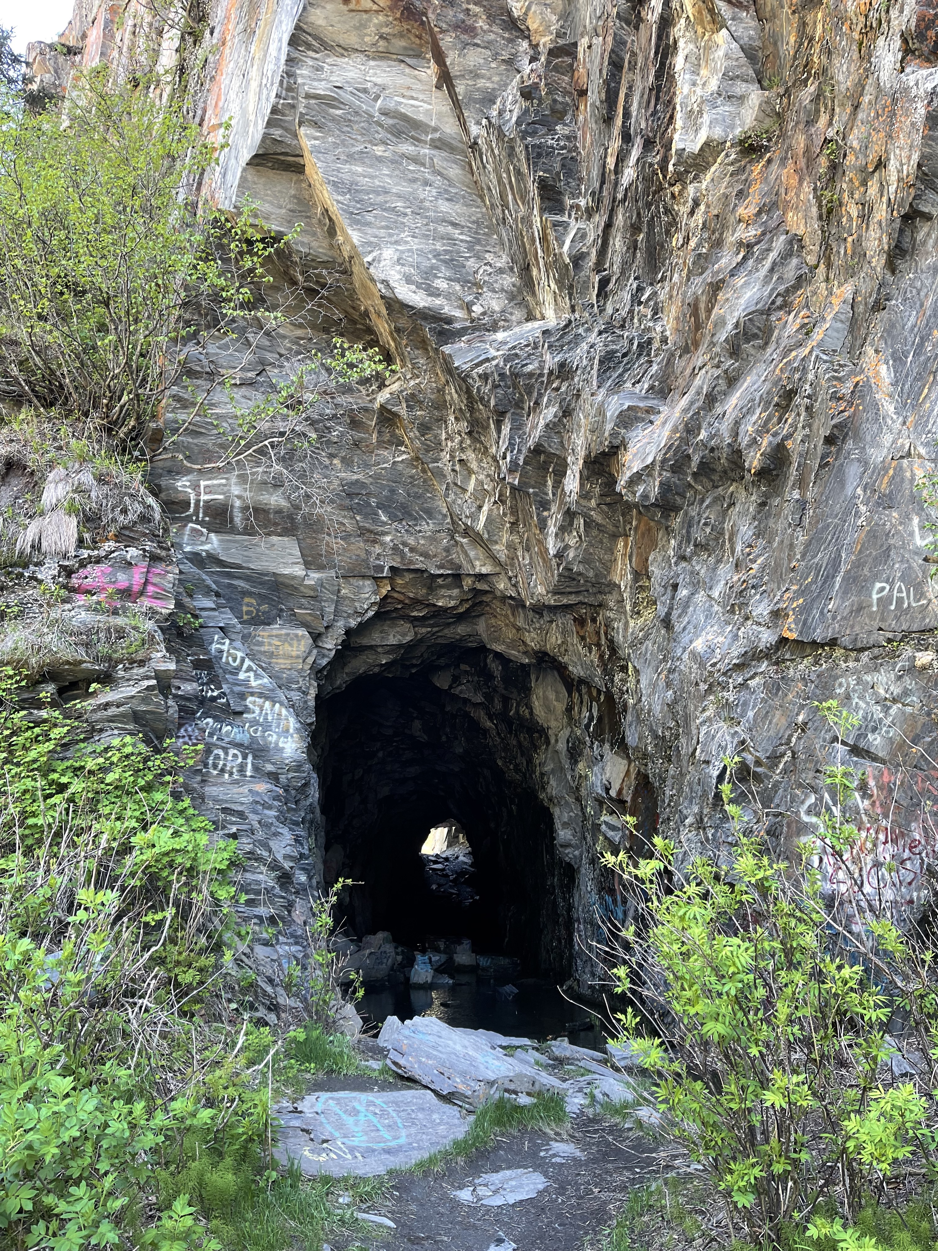
Coming up the canyon we saw the remains of Alaska’s rough past: mule pack trails high on the mountain side, a rough old track that started as a mule track and eventually was widened to accommodate cars, including a short tunnel. The first car traversed this track on the way to Fairbanks in 1913.

Another tunnel has a sign describing the Railroad Era, when nine companies fought to be the first two run a rail from Valdez to the copper mines on the other side of the pass. Things got so bad that gunfights erupted and the trail was never finished, even after a series of short tunnels were hand-cut through the rock.

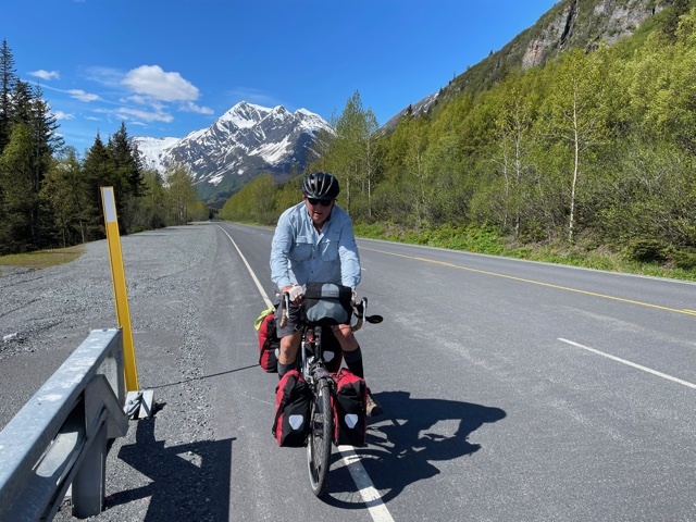
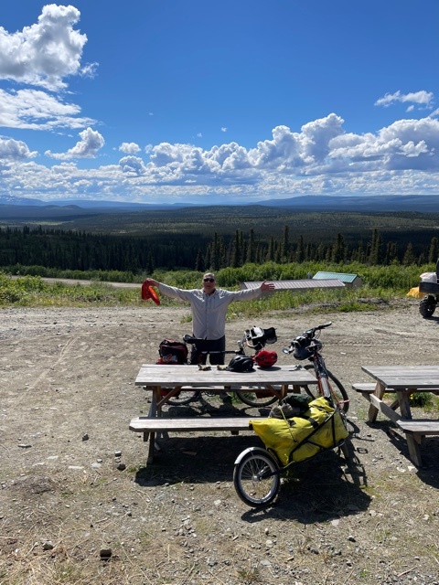
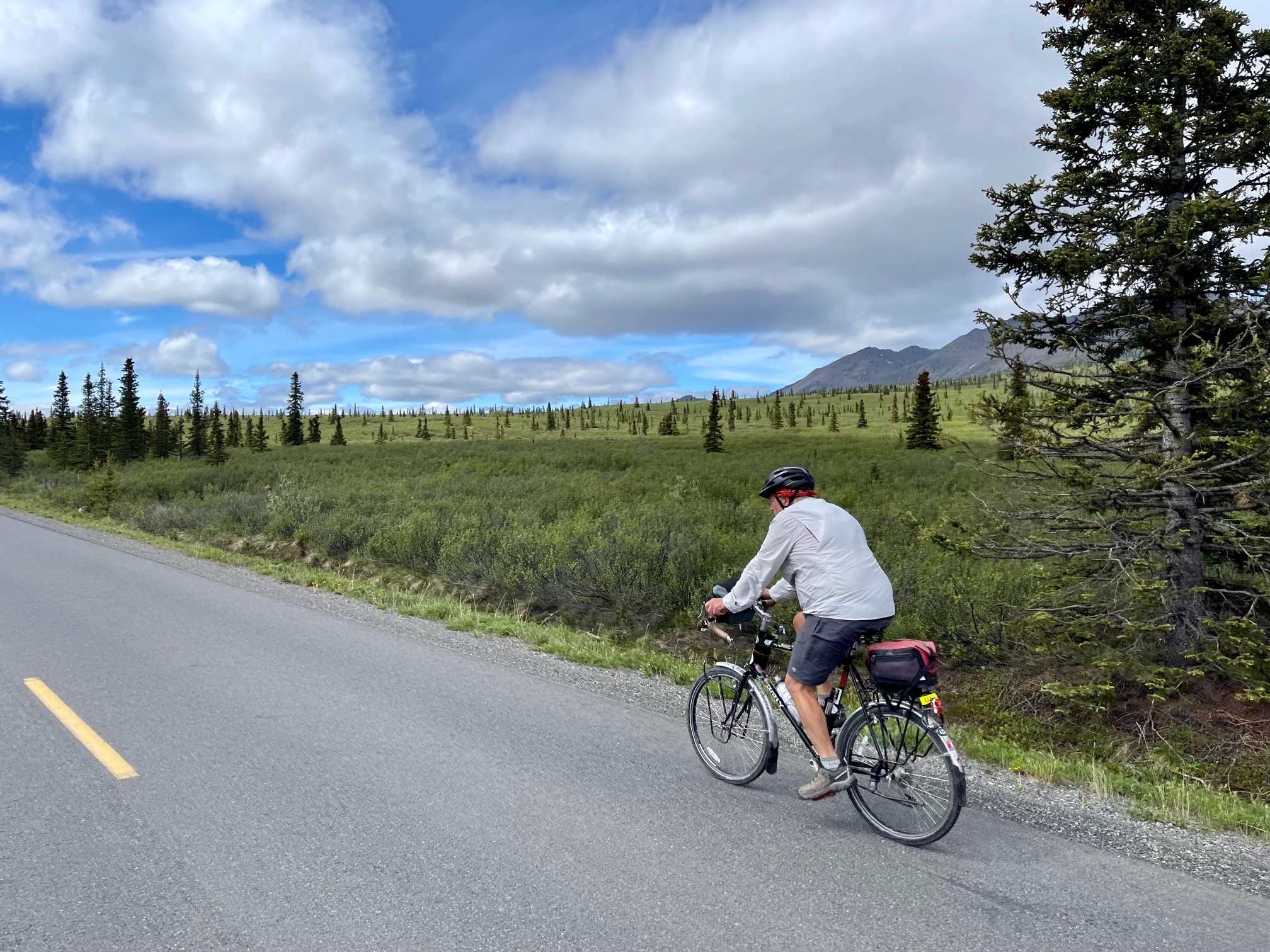
Back to the climb: there are times on tours like this where you alternate between complete exhilaration (how the fuck did I get so lucky that I can be out here in the middle of this?) and doubt. I haven’t climbed a hill like this since 2009, but I had no doubt I’d make it up. The only question was the condition of my knees after finished. My biggest single-hill climb since knee replacement in 2018 was probably a couple hundred feet.

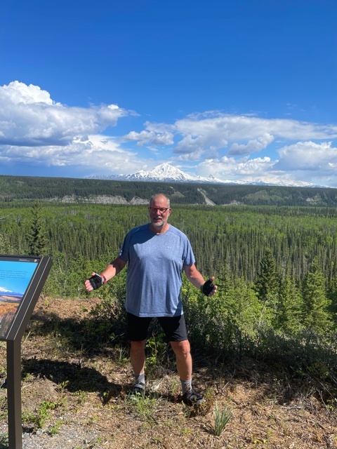
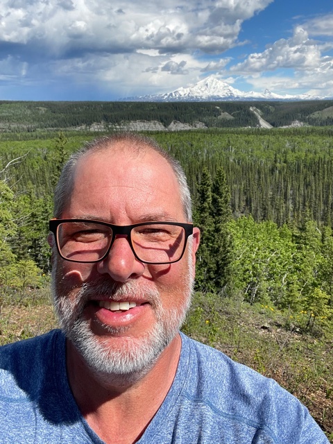
The pictures don’t do it justice, and I certainly can’t here, but snow-covered mountain ridge after snow-covered mountain ridge into the distance completely transports you.

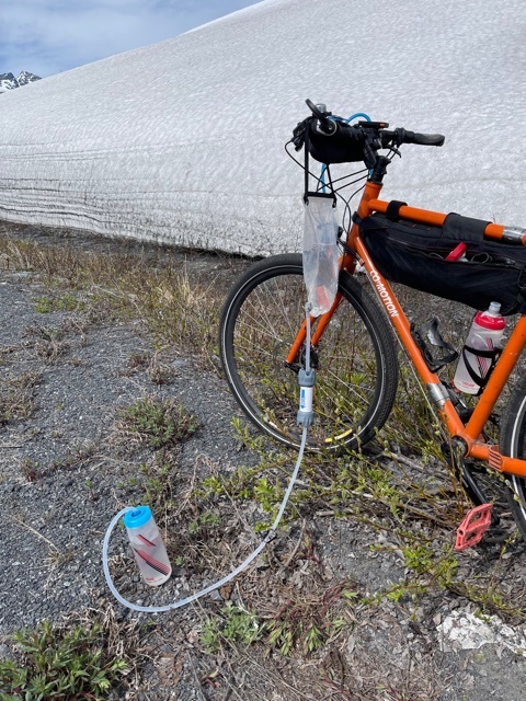
Near the top a mountain stream ran right next to the road so we each filtered about a gallon of water, alleviating one of our biggest worries: running out. Luckily it’s spring, there’s water everywhere, and the filters are working great.

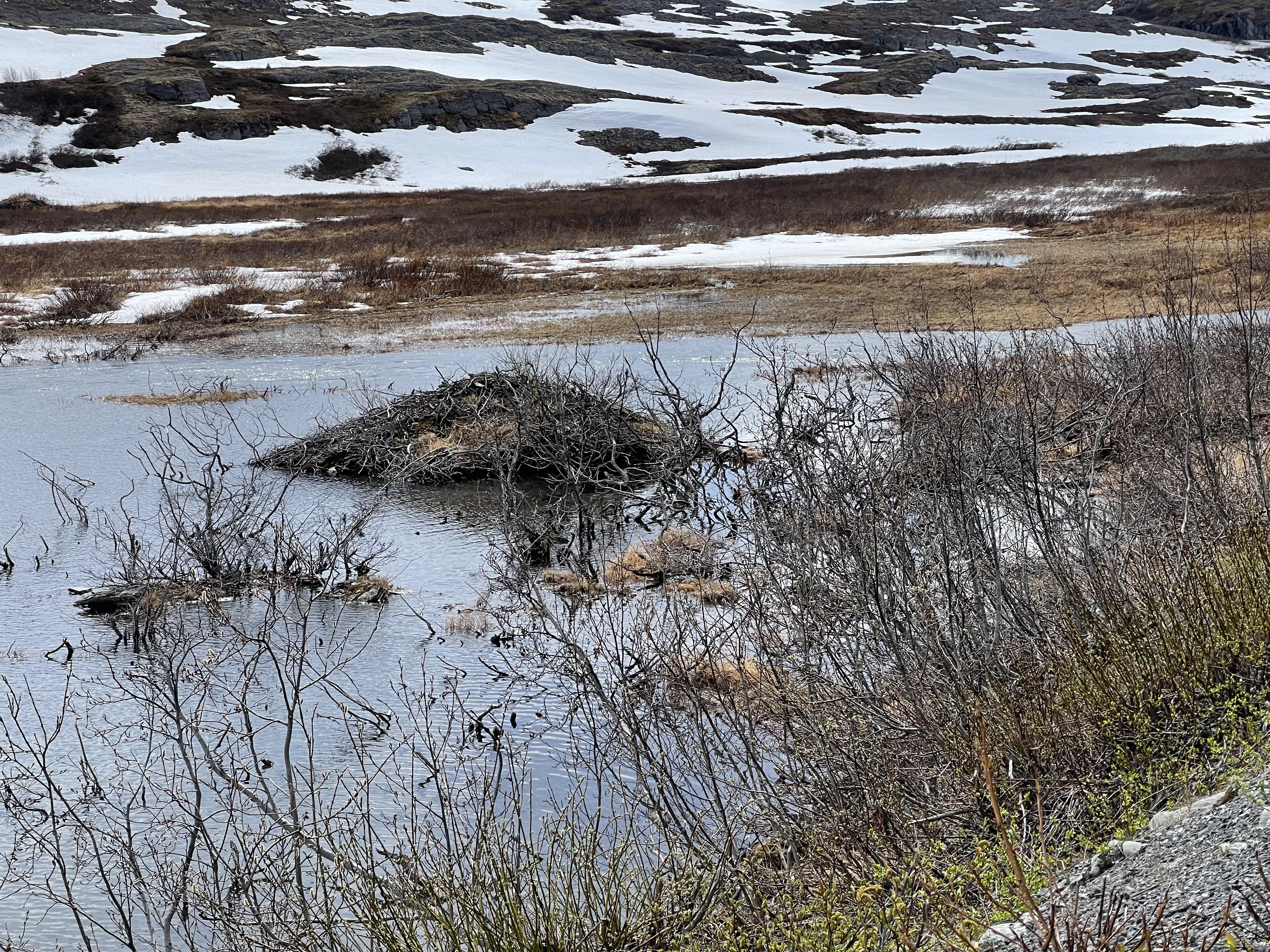
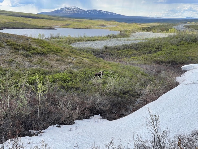
I have to mention that early on, the great woodsman Henry said that we could probably drink directly out of the clear running streams because there wouldn’t be any beavers to dam things up and breed ghardia, p. Half a mile later we passed a sign for Beaver Pond Trail Trail, and just over the top of the pass we saw several beaver dams and lodges :-).

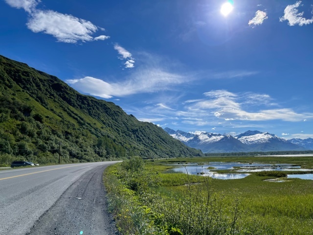
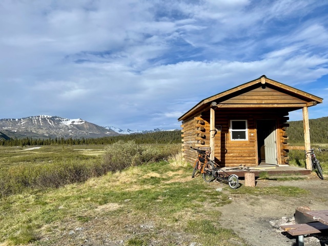
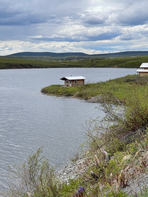
Going down the other side was mostly a downhill run. We thought about stopping at a hotel/restaurant on the way down, but we didn’t want to stay at a hotel and hoped that another lodge/tavern would be open 10 miles down.

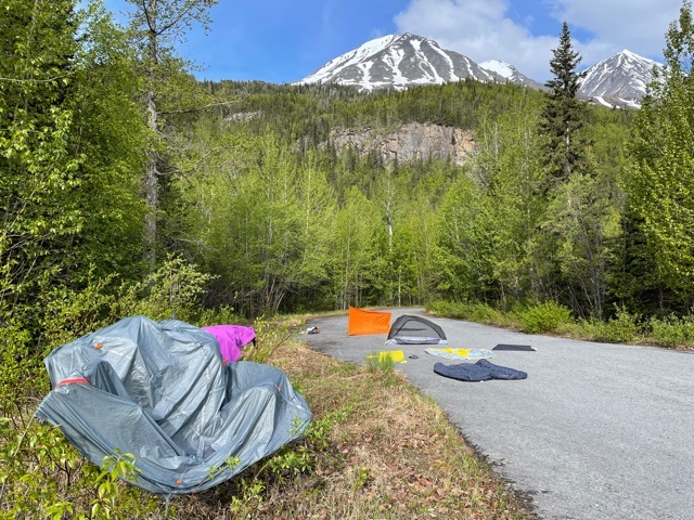
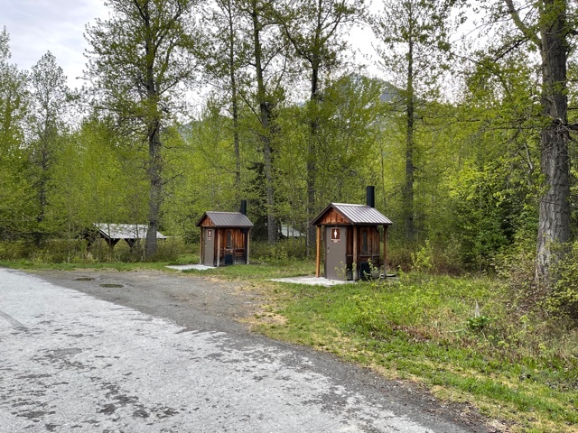
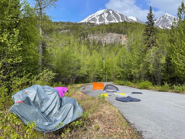
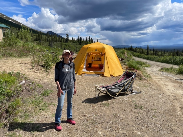
Alas, it was closed so we proceeded on to the “Billy” Mitchell memorial wayside, which has a paved loop with four covered picnic tables, and two pit toilets, happily outfitted w/ TP and trash bags.

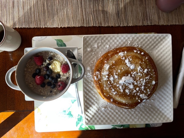
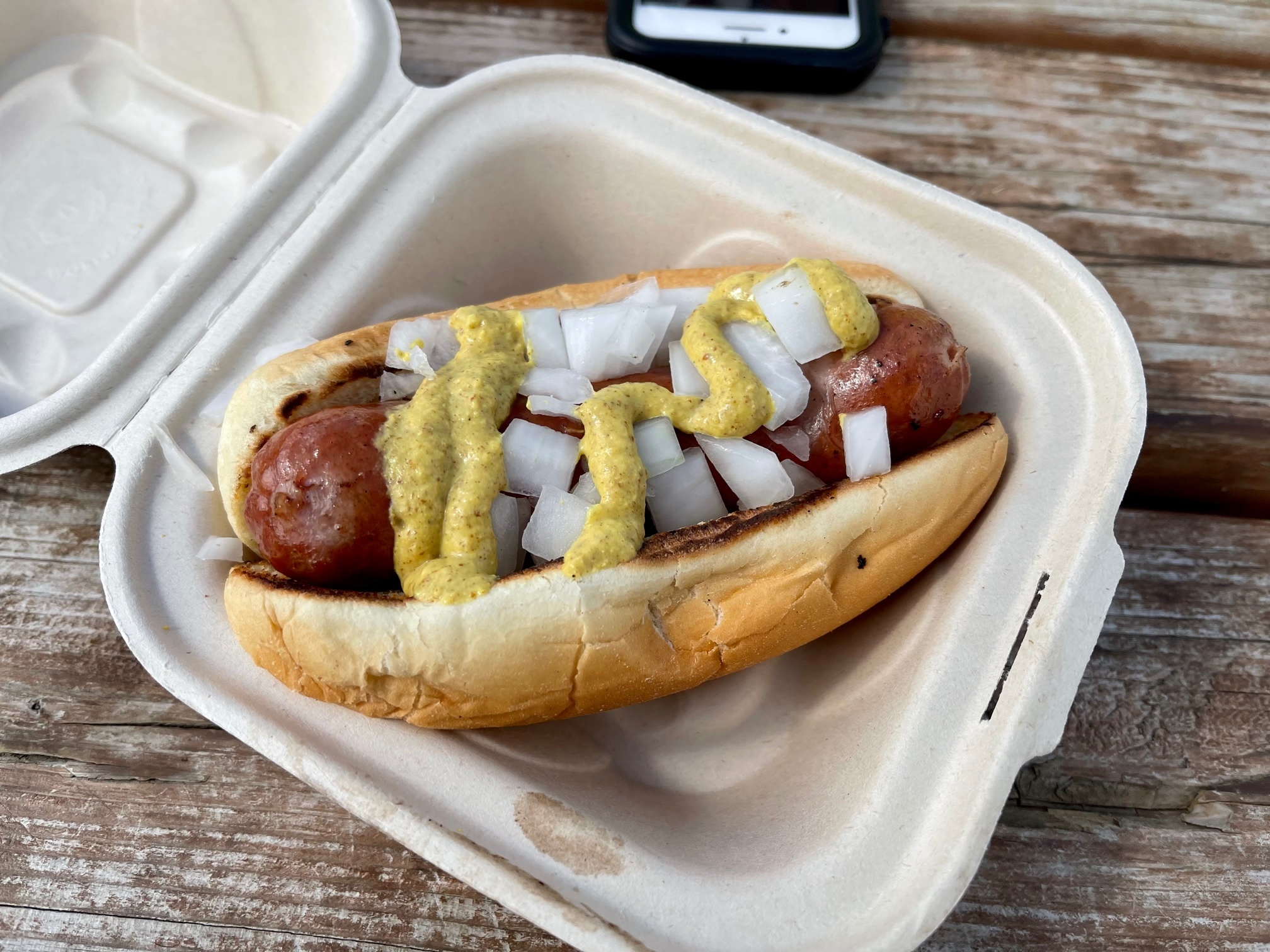
Dinner was freeze-dried spaghetti (so good, I kid you not), and salted cashews, chocolate bar for dessert.

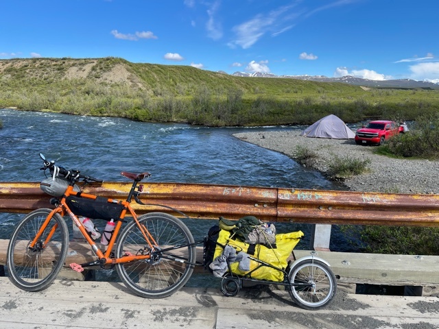
Afterwards we biked back a mile to a bridge, hoping we could get down to river bank to clean up. There wasn’t a good way down, so we ended up filtering more water and then wiping down from a shallow creek running down the side of the Richardson Highway.

I needed to change pants and there wasn’t any place to go, so I just dropped trou right there on the highway. Traffic probably averages a car every three or four minutes. :-)

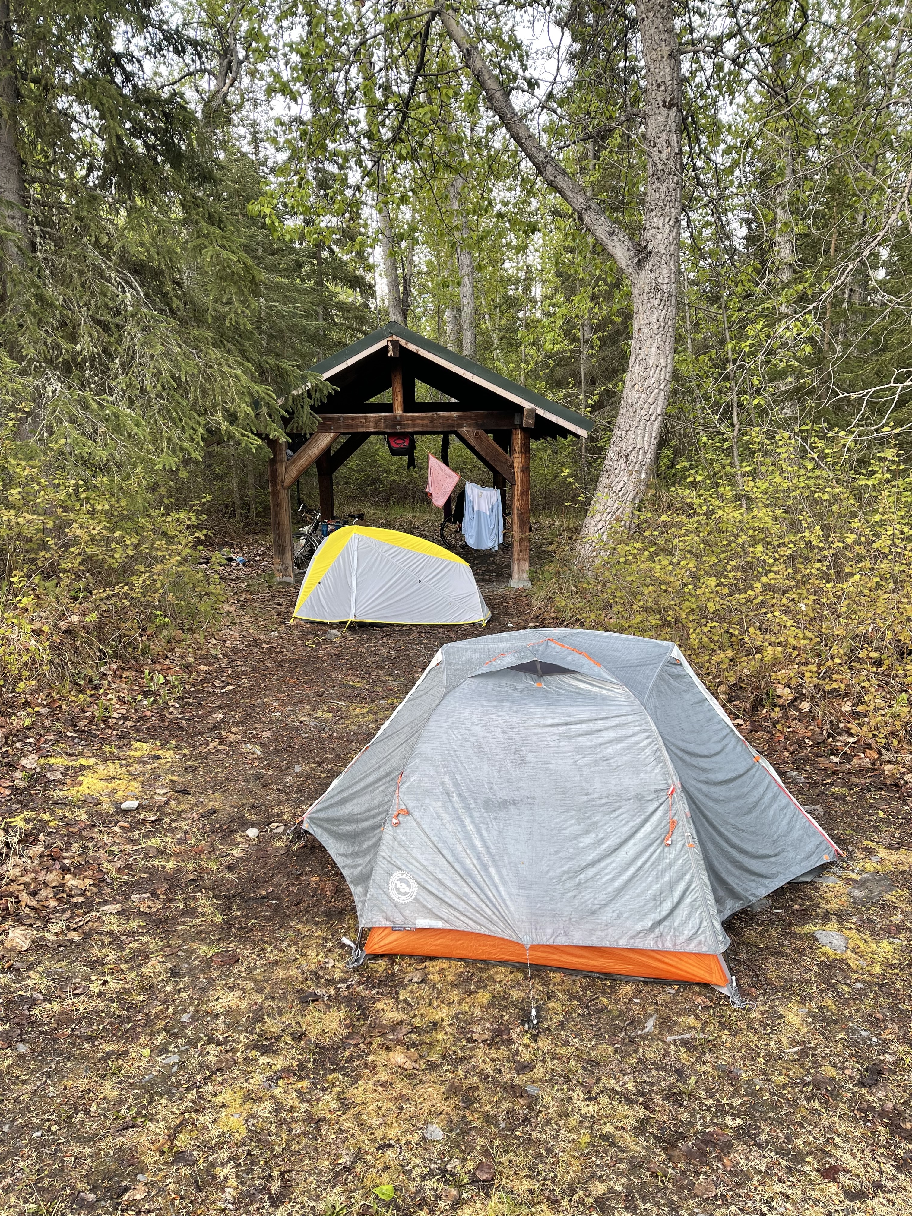
We set up our tents at one picnic shelter and cooked at another, hanging the bag from the rafters after we were done.

We slept great, though I think temperatures must have been in the 30s, and even though I got up an hour and a half ago, retrieved our food, had a couple servings of oatmeal-coffee, Henry snores still.


Heading North
Day 8 - 6/06/2021: 32 miles (157 total), 1250 feet (5685 total)
12:35 am
(2033)

Yesterday’s total elevation gain was nothing to write home about, but that was a grueling climb. Both of us are still feeling it today. Luckily, we only did 31 miles.

As we headed north, the road grew rougher, we started having more traffic, it and it looks like weather is coming in. We had a choice between staying at a clean, cheaply furnished, but not cheap lodge, or going 0.4 miles further to an unknown campground.

Obviously we could have done both, but we were both wiped from yesterday so we immediately took a room :-). While I was napping, Henry wandered down to the campground and says it’s real nice. Oh well, I had a nap. And laundry! Henry had a “Russian Pot” for dinner!

Even if the campground would have been nice, and we sleep out in the rain all the time, nice to be indoors watching the clouds roll in through the open door.


Proper breakfast!
Day 9 - 6/07/2021: 41.9 miles (199 total), 1750 feet (7435 total)
12:25 pm
(2034)

Last night we dithered about whether to go to the very nice Squirrel Creek Campground (wooded sites, water, pit toilets), or stay at the hotel. In the end the hotel won out, mostly because we were both still a bit wiped from Thompson Pass the day before. Good decision! We slept great on our twin beds, probably got nine hours of sleep.

Breakfast was finally a proper touring breakfast: truly excellent pancakes with slightly crispy exterior fluffy insides, and maple syrup, plus oatmeal! And coffee, lots of coffee.

This fortified we headed out. The highlights of the day were just the fantastic vistas we had. We were/are traveling past Wrangle-St Elias National Park, which is the largest national park on the continent.

We had views of a trio of three mountains the whole day. The one in the middle is Mt Wrangle, which has four times the volume of Mount Rainier, i.e. Denali. It’s actually further back than the mountains on either side of it. The one on the right is Mt Blackburn, which is over 16,000 feet.

We also stopped at the park’s visitor center which had outstanding facilities, overlooks, and what Henry said was a very good 22-minute movie about the park. I fell asleep.

Camp tonight is an RV park near the intersection of the Glen Highway (to Anchorage) and the Richardson, which we’ve been traveling from Valdez. It’s filled w/ fir trees, but is actually pretty crappy for renters. You’re either on gravel or a plywood platform. I’ve had rave reviews of this place from others, and the ACA stays here. Confirms my view that most bike tourers care only about the showers.

We also took a detour down into Copper Center: a remnant of early last century when one company took over $100 million in copper out of the valley. Now it’s home to 3500 quirky or otherwise slightly different people. We had a great lunch at Nummy’s: a place that had a number of…interesting… signs, including “For the safety of our customers and staff: No masks allowed!”


Into Grizzley, Pipeline Territory
Day 10 - 6/08/2021: 48.3 miles (247 total), 2378 feet (9813 total)
9:44 pm
(2036)


Today we went from the conjunction of Glen Highway (from Anchorage) and Richardson Highway: Valdez to Fairbanks. This was supposed to be a 56-mile ride, but we had a couple construction zones, both of which led to interesting conversations.

In the first zone we spent 15 minutes talking to the flagged, a native people woman who’d been at the job for 18 years. She summarized her live in a few quickly: worked 20 years as a cafeteria worker, had a death in the family and started drinking, so didn’t work for two years, and then has been a flagger for 18 years. Now she lives for her grand-kids and is waiting to hit 40 years in the state system to retire. What is striking is that nowhere did she ever seem to think that she had a higher ceiling. That’s tragic. Then we tossed our bikes in the lead truck and drove off.

At the second construction zone the lead truck was smaller, and there was no room for three in the cab. I knocked on the window of the first pickup in the line and asked if he’d give me a ride. He grudgingly let me in, and then talked my ear off the entire trip. He worked pipelines, so that naturally got me interested in his job. Turns out he works mostly outside on both the pipelines and the pump stations. Last year he was out working in -50 w/ 30 mph winds, multiple times. He was on his way back to Fairbanks to see his wife and kids for the first time in two months. I mentioned that we were going to try to stay at the Meiers Roadhouse, and he said that he’s lived there for a couple months last year, then thoughtfully said that he should stop by and say hi, as the people who ran it were good people.

I mentioned that the last flagwoman had told us that there was a family of six grizzlies that were seen frequently over the next 10 miles (really freaking me out). He remarked that the grizzlies in the area were well-fed, and therefore basically foragers. Grizzlies further north were hungrier, and more dangerous. Black bears, by contrast, were more likely to attack humans, but you’d probably survive. They have had about 25 black bears hanging out at the oil docks in Valdez the last few weeks because they are waiting for the salmon to run.

The woman who runs the roadhouse introduced herself as accountant/chef/welder, and remarked that last year gave she and her partner a chance to enjoy all the beauty nearby outdoors and were trying to have a better balance in life. Part of that is not being open to everyone all the time, and catering more to the pipeline workers. However, she immediately found a room for us and invited us to join the workers at 7pm tonight, and would give us breakfast in the morning as long as we would get there at 6:30. She also has a bare-bones cabin that she lets cyclists use for free if nothing else is available.

We’ll see how dinner w/ the workers goes (I’m picturing Marisa Tomei saying “Yeah, you blend!”), but this has been a pretty neat day.

Tomorrow is potentially the longest day of our tour, could be either 68 miles (if we go to Donnelley Recreation Site, which my pipeline buddy said was absolutely beautiful), or 57 miles if we bail and go to the posh hotel.


Slight change of schedule
Day 11 - 6/09/2021: 38 miles (285 total), 1450 feet (11263 total)
6:32 pm
(2037)


The plan today was to go 68 miles up to Donnelly State Recreation area, but Henry was feeling a slight tightness in his knee, so decided to detour instead to Fielding Lake, where we had reserved a cabin for tomorrow night. We found the cabin, it wasn’t reserved so here we are! Layover day!

We have plenty of food, a bit of firewood, filters for the icy lake water, and, wonder of wonders, I have cell service even though Henry doesn’t.

The plan is to just chill the rest of today and tomorrow, maybe hike around the lake a bit, and then head back down to the Denali Highway the day after. The *second* day on the Denali we have a cabin w/ shower and access to a restaurant. In the meantime, we’ll try out Henry’s solar shower, which is basically just a dark-colored bag that you set in sunlight for a bit and then you have a bag of vaguely warm water that you can hang from a tree, if there were trees.

We are over 3000 ft, well above the tree line, so it’s nothing but brush, lakes still partially frozen, and the beautiful mountains in the distance.

We are going to chill out in our remote cabin in the vastness of central Alaska.


Layover Day
Day 12 - 6/10/2021
8:34 pm
(2039)

Today has been a lazy day, and that is a good thing. Bike tours need a day per week off, otherwise it can turn into a grind and small problems can turn into big ones. I went on a long walk (over 12k steps), read for hours, and took two naps. We both took solar showers and did a bit of laundry in the river. I saw what seemed like two swans fly over. Enormous, white birds. I spent 20 minutes on the phone with t-mobile buying another 50 mb of domestic roaming data. Free unlimited roaming in over 100 countries in the world, but only 200 mb in Alaska. Go figure.

Henry has been keeping the stove burning all day, and watching ice flows smash into a big rock in the river :-).

Tomorrow, we get to the Denali Highway, over 130 miles of mostly gravel and dirt, and including the highest pass we go over on this trip. Our cabin is at around 3100 ft.

We should have WiFi at least once during this span, but no cellular at all. Once out the other end, June 15th at latest, we should have cellular again.

Off to finish my book!


Denali Highway At Last!
Day 13 - 6/11/2021: 42 miles (327 total), 2500 feet (13763 total)
8:37 pm
(2040)

I first heard about the Highway from an RV-er when I was touring southern Alaska back in 2017. Her eyes just got wide when she started talking about it.

I looked into it, and it seemed kind of wild and crazy: no cell service, over 100 miles of dirt/gravel, crazy changeable and extreme weather, but utterly fantastic scenery, remoteness, and big skies.

So this year Henry and I finally got out here and today we started on the highway. The sign warning us off was fun, and then we climbed 1000 ft at 6-8% right off the bat. But the scenery, it was spectacular. As we got further in it was pretty much the same scenery, but the mountains got closer, and are now all the way around us.

And the skies are big! We can see rows and rows of mountain ranges, some of them over 20 miles away. We can see rain squalls in four or five different places with blue skies in between.

The weather is indeed changeable. Going up it’s hot, going downhill it’s cold, as the sun is bright but the air temperature is only 55-ish. And we are going up and down: the highest point prior to today was Summit Lake, a mountain lake at about 3250 ft. Today we went up near 4000, down under 3000, and are now back at 3000. Much warmer than higher up!

Then the road curved and we ran right into one of the rain squalls. After a few minutes it turned into hail. Combined with a fierce headwind it hurt. A few minutes of this made me wonder whether we should find shelter…..and then we were out.

Descending into the Tangle Lake Campground area we encountered possibly the worst swarm of mosquitoes I’ve been in, and that’s saying something. Luckily the campground has a good breeze and the mosquitoes weren’t currently in evidence.

However, the friendly campground host told us of a new lodge a mile up the (gravel) road, so we jumped on it. So here we are, having pizza for dinner, fresh.y showered, with blueberry pancakes promised for morning.

Henry’s claimed the single queen bed (I did last time), so I’ll be sleeping on a twin mattress on the floor. Good deal!

Also, they have WiFi, though it’s hit or miss. Hopefully this will upload. No guarantees about pictures.


Big Freakin Country
Day 14 - 6/12/2021: 40 miles (367 total), 2114 feet (15877 total)
7:07 pm
(2041)

Today we made it to the Denali Highway proper, i.e. enormous views, and gravel roads. The roads so far are chip-sealed, i.e. rocks set in some sort of cement, but eroding and strewn w/ gravel. It isn’t bad at all.

Hard to do this place justice, because you can’t imagine how big it is: you can see four or five different weather systems in one glance, you can see multiple mountain ranges and often a couple glaciers in a glance, and just a huge amount of space.

Henry was immediately comparing to our previous most scenic ride: the Canadian Rockies, and thinking this is better. I’m not sure yet, but at worst it’s #2 and we’re only 42 miles into the 135-mile highway!

There are other people out here, but camping, and lodges. Tomorrow will be our third night in a cabin w/ access to a shower! Yes, we’re roughing it, as I sit here w/ my chili fries and an IPA. After that we will be staying at a wayside w/ nothing but space and a view of Denali (weather cooperating), and then camping three nights in Denali, so we’re not total wimps.

The 21 miles we climbed today were actually kind of hard, both because most of the climbs were in short steep sections, because we’re 4-00 ft up, and because we are on an uneven gravel road.


40 miles on dirt
Day 15 - 6/13/2021: 40 miles (407 total), 2114 feet (17991 total)
11:22 pm
(2042)

Well, not quite dirt. The first 20 miles of the highway seem to be almost all regular pavement. The next 40 miles are chip-seal: rough but nothing loose, no potholes. The next few miles were beautiful dirt road: smooth, soft, fast. Then the potholes started, the headwind started, and the ride became just a tiny bit more difficult.

The scenery has still been spectacular, including a couple views of a mountain way off in the distance that might be Denali. Skies most of the day were blue-bird, we’ve just been incredibly lucky w/ the weather all along.

Really interesting people we to talk to today. People are amazed what we are doing, but one of the proprietors of one of the lodges says that she thinks perhaps 50 self-contained bike tourers come through each year, but we’re the first. Five minutes later we saw two self-contained tourers going the other way before we were able to get down to the road.

Last night and this morning we talked quite a bit w/ Dave and Kat, two accountants from Vermont who moved up and don’t ever intend to go back. The twist is that Kat is crazier than we are. She planned to do a 160-mile training ride. She’s trying to get to the RAAM (https://en.m.wikipedia.org/wiki/Race_Across_America), a race across the country that usually is won in about a week - on a bike. Entrants do not get any help from their support staff. They sleep on the side of the road, eat whereever they see food. Kat is totally believable as a RAAM rider. Right now she’s thinking that 2024 might be the year for her. Most of the qualifiers over the last year or two have been cancelled.

Later we stopped at the Alpine Lodge for lunch and I talked to Casey (rock-on racing). Casey and her husband have been up here for about 20 years (they are from Michigan, used to go to Cedar Point where I worked in high school). Last year they decided to get into sled dog racing, bought some dogs, and their dogs (and kids) have been competing ever since. Both she and her husband have been in 400-mile races, and their then-11yo competed in a 100-mile race. It was closely monitored w/ a mandatory rest stop, but an 11yo doing a 100-mile sled dog race!

Tonight is probably our last night w/ a roof over our heads until we get back to Anchorage. Tomorrow night we plan on sleeping at a wayside 13 miles from the end of the Highway, and then we will be camping three nights in Denali National Park.


Denali!
Day 16 - 6/14/2021: 53 miles (460 total), 2722 feet (20713 total)
9:56 pm
(2043)


52 miles on dirt….done

Denali Highway on touring bikes self-contained…..done!

Biking Anchorage to Denali via Richardson Highway….DONE

Seeing Denali as we came down the Highway…. DONE!!


Into Denali National Park
Day 17 - 6/15/2021: 34 miles (494 total), 563 feet (21276 total)
1:08 pm
(2047)


No pictures today. The ride to the park was fittingly only 27.5 miles, only a few short climbs, maybe 7-8 of miles downhill. The scenery was beautiful, but after the Highway it’s hard appreciate it.xvxm34.5m538m.

We stopped once for second breakfast and talked for a bit w/ three 20-somethings: they are from different places but come here for the summer season. One goes home to Georgia in the winter, the second goes back to Fairbanks, the last goes out to Jackson WY for his second career as a ski instructor.

The girl from Georgia was a hoot. She talked like a flower child from SF. She saw Henry’s bike and stopped dead: “Is that a Surly Long Haul Trucker?” Henry laughs and agrees. “Ooh…that’s my dream bike, and I love your stickers.”

“Um….I have one too, “ I interjected. “It’s back in my garage.” Silence.

“Can I, can I touch it?” she asks. This is getting seriously weird. Henry holds it in and nods. She puts out both her hands and practically fondles the top tube. It was like veneration of Christian relics.

Then she bounces up: “Okay, have a great day!” and strides away, the other two in tow.

By the end of this conversation the clock had inched past 11am and the cafe was no longer serving breakfast. Salmon chowder instead of eggs Benedict.

Park operations are a bit different than usual. First, the mercantile requires masks. We haven’t used a mask since the train to Whittier on the second day of the trip. However, the other park store doesn’t require them if you’ve been vaccinated. Nonetheless, you have to go in the mercantile to check in, and for…well…the caramel caribou ice cream.

The showers are closed for the summer.

We weren’t really planning on going deeper into the park today, but in any case we can’t, as there’s an unspecified “bear situation” a few miles down the road. A ranger gave me a number we can call to check on the situation when we do want to bike the road a bit, and also to get an escort if the situation is still a thing.

Right now I’m typing this outside the mercantile (WiFi and more caramel caribou), watching the first non-negligible rain we’ve had on the trip come down. I kind of figured this would happen, as tomorrow morning I’m supposed to go Flightseeing in a small two-engine plane.


Up in the air
Day 18 - 6/16/2021
3:36 pm
(2048)

Pilot was a crazy fuck (in a good way). No views of the high reaches of Denali, but zigzagging down the Alaska range was nuts.

Really great airplane ride. I got to ride copilot :-)


Up the park road
Day 19 - 6/17/2021: 22 miles (521 total), 1743 feet (23019 total)
10:05 pm
(2051)

The rain today went on until 1pm, but afterwards it cleaned up quite nicely. Henry and I wanted to go deeper into the park, now that the “bear situation” has been resolved (moose carcass removed), so we headed deeper into the park.

Quickly we got away from the crowds, the cars, the dogs and started climbing through virgin pine forest. The terrain slowly changed to alpine tundra as we climbed nearly 1500 ft.

There was definitely a different feel to the ride, even though we really didn’t go far (total ride 20 miles). It also felt great to be back on the bike after a day of sloth. After wondering whether my next bike should be that fancy Cannondale e-bike, it felt great to be grinding up the hill, all the little aches and pains fading away as we climbed higher.

Life is good.


Back to Anchorage on the Denali Star
Day 20 - 6/18/2021
12:04 am
(2054)

The Denali star is an experience all to itself. We had two good meals, fantastic panoramic views, and an outdoor area to sightsee. To top things off we saw the only bear of the entire trip: a black bear sitting happily in the middle of a field of green, watching us go by.

And another beautiful view of Denali.


At the airport
Day 21 - 6/19/2021
9:47 pm
(2053)

What a beautiful state Alaska is, and what fantastic roads we went over. Thompson Pass out of Valdez and the Denali Highway were everything that we hoped for, and seeing Denali from the Highway and from the train on the way back was just the icing on the cake. I hate to compare trips, and it’s too bad we only ended up with two on the trip, but this trip is right up there with the Canadian Rockies, it was that good.

Great trip in the books. On to the next one!